Sunday, August 08, 2004

North Fork Dore, BC - Canada


Dore Valley Posted by Hello

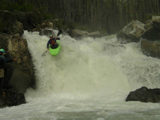
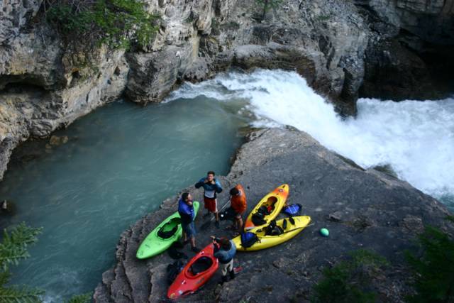
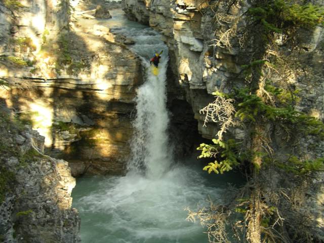
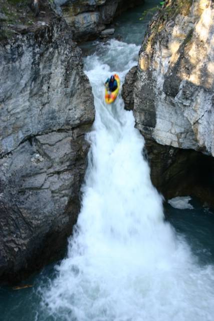
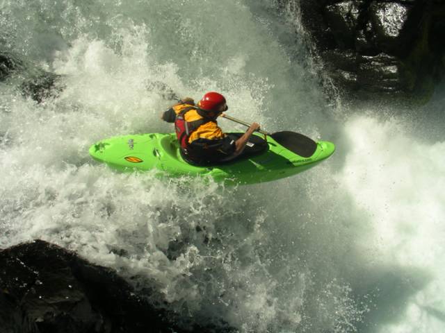
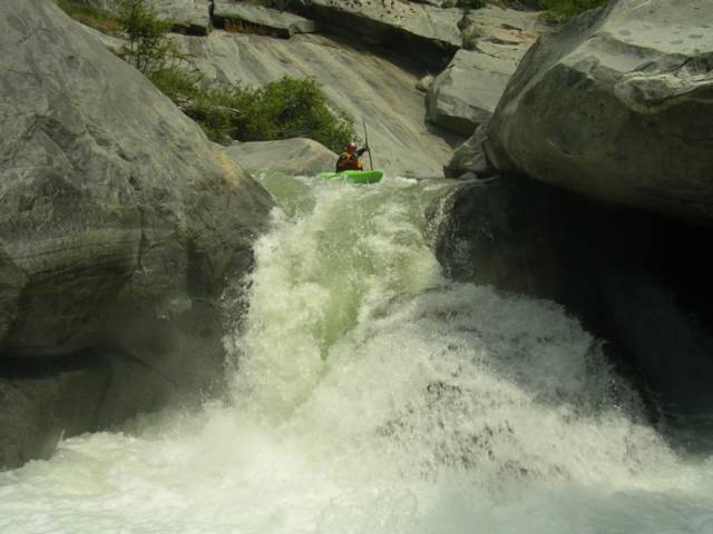
The North Fork of the Dore is a challenging technical class IV-V creek that will keep you busy all the way to the end. We rolled up the Dore Valley (about 20 km off of Hwy. 16 and 25 km from McBride B.C.) to the confluence of the South and North Fork runs in the evening. Camping is good at the confluence but watch out for the cows in the morning if you don't hear them rolling through in the night. Next morning we set off another 13 km or so up the North Fork road until once again there is a bridge crossing the river. If you are charging this one beware of the Gnasher, a lengthy technical line that sends you into a powerful maelstrom of white. Jordie and I looked at a possible entry above the river right pour over and then decided to go for it.........


Jordie M. boofin' the Gnasher river right Posted by Hello

The rest of the run maintains a constant gradient until the final 3 km which is even steeper. Overall the North Fork of the Dore is worth checking out on one of those hot summer days if you are in the area. 2hrs from Jasper AB, 3hrs from Clearwater B.C.

For more logistical information on the Dore, check out Spencer Cox's Kayakwest website.


Vis N. Dore River (V) i et større kart

Thursday, August 05, 2004

Toby Creek, BC - Canada

Toby Creek's infamous seven canyon run is one of the best runs in Southeastern B.C. Draining the Toby and Jumbo glaciers, this run explodes into unrunnable levels many times throughout the summer. It is predictably high when heavy snow pack and extreme heat collide so know your levels or prepare for a hike-out that is a story in-itself. A good time is in August and even into September.

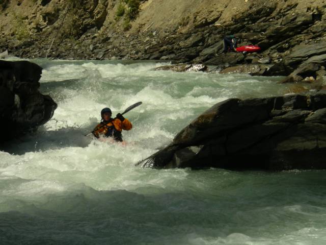
Although I'm sure there actually are seven canyons you paddle through, I like to think of the river containing: #1. Class III-IV technical whitewater up until, #2. "Juniors", a class IV-IV+ pinch with a revealing undercut ledge river-right.


Heather Armitage and the undercut before "juniors" Posted by Hello

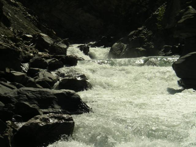
After "juniors", the river picks up until the class V crux canyon containing #3. "Smitty's" and a NEW slide drop rapid (spring 2004) which leads up to "picket fences." If you are on the Toby at high flows this section will either be heaven or hell.


Looking upstream to the new slide drop and the entrance of "picket fences" Posted by Hello


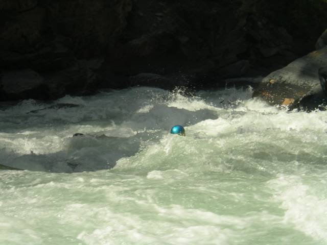
Jordie's sparkly helmet amidst the "Picket Fences" Posted by Hello

Just before you think it is over, #4 the seventh and final canyon has NOW CHANGED (spring 2004). This section is still long and constricted. Instead of the traditional river left scout, eddy out on the river right where a new gravel bar has formed to check this rapid out. Once you're through this the river flattens out.

Location: Invermere B.C. (road to Panorama Resort is put-in and take-out)

Friday, July 16, 2004

Beauty Creek, AB - Canada


A 25 minute hike up from the highway. Joey Vosburgh, Jordie MacKenzie, Dave Manning and Mark Basso gear up on Beauty Creek in Jasper National Park.

Beauty Creek lies hidden along the endless chain ridges which parallel the Sunwapta river near its headwaters in Jasper National Park. Fortunately this long mountain corridor between Banff and Jasper National Park also contains the main highway 93 which by summer months, offers easy access to the beautiful scenery and receives many visiting travelers. It is also during these long-awaited days in late June when kayakers begin to pass along the road in search of some excellent paddling runs in the Central Canadian Rockies. Although the runoff window for Beauty Creek is small, there are now annual visits to this short but intense alpine creek consisting of 8 major waterfalls and slides, 6 of which have been run.


25 ' Lumbarsis creates drop number two on the run.

Beauty Creek was probably first explored by known paddler Stuart Smith back in his days as a local Jasper raft guide. During these long Summer months more than a decade ago, Stuart made valiant attempts seeking out rivers in the Central and Southern Rockies. Since those days, local and foreign paddlers alike now use his guidebooks as a popular source of paddling information for over 200 river runs in B.C and Alberta. A while back Eric Link and the Twitch crew paddled Beauty Creek with extremely low flows, breaking a couple of boats on the way down. Check out 2002's Twitch TV for some good scenes.
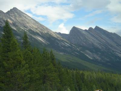

Slanted slopes of the Endless Ridge Chain found near Beauty Creek in Jasper National Park. Posted by Hello

From the heart of Banff National Park, the scenic Banff - Jasper Icefields Parkway (route 93) begins in Lake Louise. From Lake Louise it is a 120km drive until you reach the Sunwapta Pass and begin a northerly decent past the Athabasca Glacier and Columbia Icefield Center. About 15km from the Icefields Center, a flat valley opens up and and it is time to start looking for a marked pullout and a small meandering stream running along the right side of the road. If you are coming from Jasper, drive south 90km and look for the run on the left side of the road. Although deceiving, you should be able to locate a mini gorge upstream where the gravel plain meets the trees. Follow the flat part of the creek east from the highway to the treeline and at this point the hiking trail will start to parallel the river right shore.
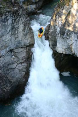

Dave Manning looking over the brink of the fourth drop on Beauty Creek. Posted by Hello

After only a few minutes of hiking, the sound and appearance of the creek changes dramatically as a tight box canyon churns down below. Here the rapids will begin to appear one after another for you to assess on your way up the inclined trail. Look for the put-in slide which begins just upstream of the highest runnable fall, Lumbarsis. A trail branches down from here for easy access. Just upstream looms giant Stanley Falls, also worth a look even if only for the magnificent views.


A meandering Sunwapta river and the takeout of Beauty Creek at sunset.


Vis Beauty Creek (IV-V) i et større kart
Monday, May 03, 2004

Canyon Creek, WA - USA


Scott Feindel following his shadow over Big Kahuna. Posted by Hello

Despite losing my 5 week old Dagger Kingpin off my truck and having it ran over by a semi-truck at 85mph, the Kavu crew along with Scott Feindel, Michelle and I headed up to Canyon Creek in good spirits for the annual extreme race, which was to be the opening event for this year's 2004 Oregon Cup. Although located close to Portland, this creek is in Washington State and is NOT to be confused with the more difficult Canyon Creek in Oregon.


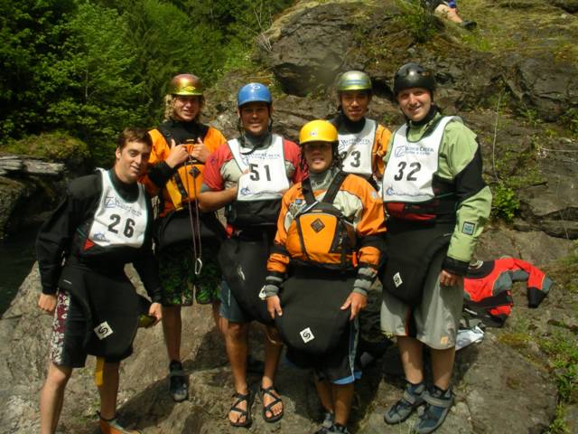
Hanging out with the World Class Academy kids before the start of the race. Posted by Hello

Canyon creek is a busy little creek that can be pretty friendly and fun to those less experienced with creeking. A couple of drops in the middle section pinch up and can be a bit technical, yet have fairly easy scouting. However once out of the tight walls of the upper section, you will soon find yourself at the brink of Big Kahuna, the first of 3 easy waterfalls (and also the starting line for the race). Basically the race begins as soon as your paddle hits the water in the eddy above 15' Big Kahuna. Upon landing cleanly you must then convert to flat-water sprinting through bony class II and III water for about 70% of the race section. As you near the finish, the final two drops known as the "Drop Zone" still must be ran cleanly before you hustle across the finish line that is located above the final drop of the creek. After the last drop, the creek becomes a lake that you must paddle across for 20 minutes to the bridge. If you are interested in challenging yourself against the clock and other fellow kayakers, the Canyon Creek Extreme Race offers a great introduction to downriver racing through drops. Congratulations to my sweet wife who won her class in the first extreme event she ever entered!


Michelle Basso launching the final waterfall before her finish in the 2004 Canyon Creek Extreme Race. Posted by Hello

2004 results and more information about the Oregon Cup can be found at: www.oregoncup.org

Thursday, April 29, 2004

Little White Salmon, WA - USA

If you ever are in the Portland Oregon area and the creek boat is on your roof, you mustn't pass a chance on the Little White Salmon River. Most certainly, the Little White ranks up there with the best creeks in overall class V creek quality, and season length. It along with the main White Salmon river, are located within an easy 25 min. drive across the Columbia River from Hood River Oregon, which is about an hour east of Portland.


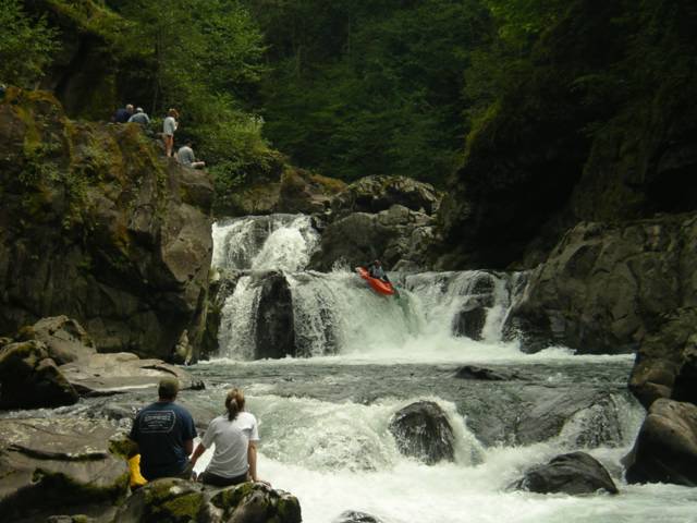
Spirit Falls awaits kayakers who want to huck near the end of the run. Posted by Hello

After pushing Mariann and Morten's out-of-gas van over the last remaining summit entering Oregon State from California, we cruised down into the night and arrived in Hood River the next morning. After some coffee, we took the toll bridge across the Columbia River and headed west down to the fish hatchery on Northwestern Lake which is the takeout. For the ultimate description of the Little White Salmon River, you can read in detail about this river and over 100 more located in the Pacific Northwest. Check out: Oregon Kayaking


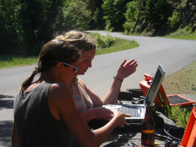
Girls playing with beers and laptops at the takeout after an epic on the Little White Salmon Posted by Hello

Thursday, April 15, 2004

South Fork Merced, CA - USA


Jayson, Scott and Mark at the takeout. Posted by Hello

The South Fork of the Merced is a tributary of the famous Merced River which steeply drains out of the heart of Yosemite National Park and rages along the main road. In April, the early California snowmelt makes the South Fork Merced come alive with the level around an ideal 1500cfs. What to expect if you are game for this intense overnighter is some very continuous pool drop class V, along with a couple of big California slides in the middle. Even after 2 weeks of ninja training on the Green River, I decided to portage more than once. Jayson and Scott on the other hand decided to fire it off.


A fluffy slide on the S. Fk. Merced...with a paddler at bottom! Posted by Hello

I joined up with Scott Feindel and Jayson Bowerman on the Kaweah River the previous day, and that evening we headed north from Fresno and entered the South Yosemite Park entrance late in the night. The South Merced put-in is in the national park village of Wawona, but within 20 minutes of class III paddling you exit the park boundaries and enter a magnificent wilderness canyon with all the class V whitewater goodies California typically has to offer.

If you knew this run well, you could probably push through the South Merced in one long day. However, you may end up paddling around 7 hours of continuous demanding whitewater. We followed the recommended option of camping overnight about 2/3rds into it. The camp comes after a hard section that ends with large distinct boulder that is in the middle of the rapid.....once in the calm water look for a level area on the left bank and watch out for the Poison Oak. The best part of breaking up this run into 2 days is that it enables you to get through most of the hard stuff on the first day and camp at an early time. Next day if you take-out early you can go hit the main Merced River playhole to cool off......yeah that's Cali....


Camp spot. Posted by Hello


Merced hole. Posted by Hello

Tuesday, April 13, 2004

Kaweah River, CA - USA

Scott Feindel back in Cali for 2004 - Kaweah River, CA. The Hospital Rock Section of the Kaweah River would serve as my introduction to creeking in California. Little did I know while winding up the steep road in Andrew Bell's old VW beetle that within the hour I would have already ran a 30 foot slide and then have my ass handed to me on a waterfall downstream. The Kaweah River flows down from an area in the Southern Sierras which is represented as Sequoia and Kings Canyon National Parks. Head East from the city of Visalia on route 198 and you will soon pass Lake Kaweah and enter Sequoia Nat'l Park. The takeout (which also includes "Brownstar Canyon" is only a mile up from the Park entrance and you can put in at Potwisha Campground. I met up with Scott, Jayson and Andrew B. in the town of Three Rivers just before the Park entrance. Andrew Bell close to home - C1 on the Kaweah.  There are numerous class V slides and drops on this section including the opening Hostpital Rock Slide and the rapid just below that constricts tighly as it drops into a boiling pool. As I came over the drop, I misjudged the line as my attention turned to Andrew who was still near the landing zone and immediatley after, "Welcome to California" would become my new name for that rapid. After this the river opens up and provides easy scouting so long as you watch out for the Poison Oak bushes and an exciting entry slide that ends with a fall facing towards the right wall. There is a higher takeout that we did not take which avoids the last canyon supposedly named "Brownstar Canyon" by one of Jayson's friends. What it really is are some more beauty drops before you reach a mini box canyon with some intimidating horizon lines. However a high climb up the right wall will put you on a ledge which reveals the goods. The Kaweah is a classic creek in California with dependble access and flows in the Spring. For flow information for the Kaweah and other Cali rivers check out: Dreamflows

Wednesday, March 17, 2004

Rio Mendoza - Argentina


November brings hot temperatures and lots of quality whitewater to paddle in Argentina. Posted by Hello

The headwaters of the Rio Mendoza flow east from the shadows of Cerro Aconcagua, South America's highest mountain located in the high central Andes. From its confluence with the Rio Tupungato, the Mendoza loses its steep gradient but grows to a meduim-high volume as it descends into the arid wine making province and city of also the same name. The city of Mendoza is a historical Argentinean location with a wonderful climate, ridiculously cheap steaks, and very friendly locals who will push your understanding of the Spanish language to the limit. Once you head west from town on the major Chile-Argentina road (Ruta 7) you will soon find yourself in the small village of Potrerillos and the home of Argentina Rafting. The actual village of Potrerillos was recently moved to a higher elevation so that more water could be stored in the lake created from the dam on the Rio Mendoza. Soon Argentina Rafting will also make the move to a new location, but for now Martin and Erica Moreno and their fellow paddling crew have a great place to eat, camp and lounge at while you get some good melt-water playboating done.


Martin Moreno at home on the Rio Mendoza. Posted by Hello

Water levels are low in October, however through November and on into Mendoza's hot summer you can expect clear blue water and many sections containing fluffy (III-IV) waves and holes. The Rio Mendoza is worth visiting even if Chilean paddling is your main goal. Those who have an extra weekend waiting for the plane in Santiago can jump on an easy 3hr bus over the Andes and be on the river by the afternoon. The views of Aconcagua, Puente del Inca, and other high mountain scenery won't be wasted even if your kayak never sees the water! Although access and information can be limited, Argentina is another paddling destination that will intrigue those looking for somewhere new. They may take a route to an opposite ocean than Chile, but rivers like the Rio Mendoza, Diamante, Atuel and Neuquen in central Argentina have more secrets to reveal. For more information about rivers and the sport of kayaking in Argentina, check out: www.kayakero.com.ar. (in Spanish)


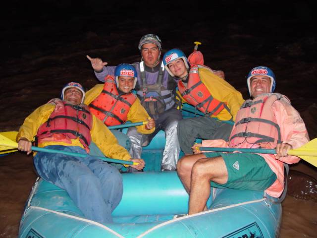
Rafting the Argentina way means lots of good wine and steak before embarking under a full moon...... Posted by Hello

Tuesday, March 02, 2004

Pichilemu - Chile


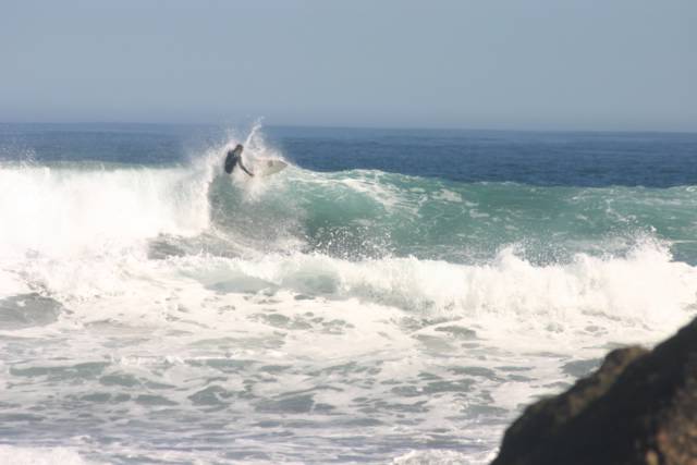
Surf's up in Chile...... photographs by David Manning. Posted by Hello

After hearing rumors about Chile's epic Ocean surf, Michelle and I again loaded up our van with fellow roadies David, Scott and Dirty Tom and headed back north 7 hrs from Pucon to Pichilemu on the Chile's central coast. The boys were just back from the Rio Futaleufu and Pichilemu would be their last destination before they flew back home to Calgary. When we arrived, we discovered a fun little Chilean beach town well known by Santiascos who flock here during their holidays in January and February. When we arrived however, the beaches were scarce and most turistas had already returned home to their normal routines. First up for us was finding a cheap hotel and then renting some more beach toys. Nearing the end of our voyages, our kayaks were limited to one creeker and one playboat between a bunch of us. David and Dirty Tom found some surf boards to rent the next morning so we were excited to see some hilarious carnage over the next few days.


Dirty Tom and David with their Pichilemu rental sticks Posted by Hello

Pichilemu has two significant beaches which wrap around some rocky points and create amazing left to right breaks. Most people would be happy at the main beach in the town, however Punta del Lobos is about 10km to the South and there the waves are even larger. Before he took to board surfing, Dirty Tom fired off some astonishing rides in the Dagger Nomad creeker that Scott was taking back to Canada.


Tom Faucher showing how a creekboat can surf the Ocean. Posted by Hello

Overall the beaches and waves of Pichilemu offer a change from the inland mountains and rivers. If you are traveling through Chile with some paddling friends check this spot out. Pichilemu is about 100km west from the Panamerican Highway (5) and there are multiple access routes in between the cities of Rancagua and Teno. Learn more about surfing Pichilemu here.


Dropping in with the Dagger FX Posted by Hello