Monday, June 13, 2005

S. Drywood Creek, AB - Canada


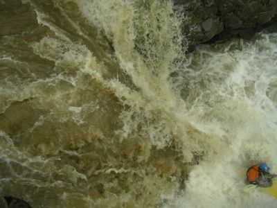
Spencer Cox sets off down South Drywood Creek, Alberta.
Photos courtesy of Chris Goble. Posted by Hello

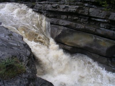
With the establishment of pipleine and gas-compressor access roads, the logistics for creeking in Alberta are ever improving. A little family history in the Southern Canadian Rocky Mountains and plentiful hiking routes has also helped in the discovery of some new creeking runs for those to explore. The North and South Drywood drainages have long been accounted for on the map, but only recently did their paddling potential become a reality. Located in the far Southwestern corner of the province near Waterton-Glacier National Park, South Drywood creek was a formidable discovery a few years back by paddler and Waterton local Chris Goble. South Drywood runs East towards the open grasslands, but not before flowing out of a spectacular alpine valley.
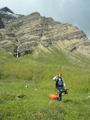

Michelle Basso winding her way through the Alder trees along South Drywood Creek.

If the gate is open (which is supposed to be the case after June 15) you can easily drive to the put-in and takeout on this run. However one can also make the 5km trek up the road in just over an hour which gives you early season access, optimal flows and a mountain valley all to yourself.

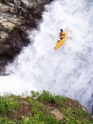
From the put-in, the creek begins with a beautiful 20 ft cascading waterfall into a tight pool.
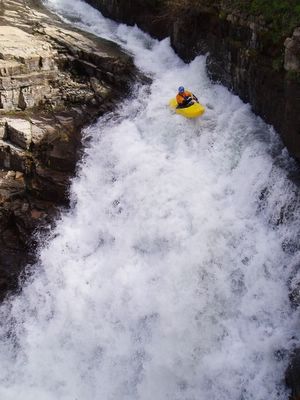


After the entry falls, eddies become scarce as the run opens up for about a kilometer flowing over multiple cascading ledges, two of which are in the 7-9ft range.


Going with the flow until an eddy appears downstream.

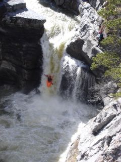
Once the red walls of layered rock begin to close in around you, start looking for an eddy on river right near the roots of a dead tree. Inside the tight canyon lurking below things begin to get vertical quickly as the creek drops into a narrow 20ft chute aptly named "Epi Pen".
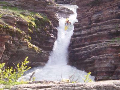

Epi Pen set amongst some awesome layers of red rock.

From the bottom of this pool the creek tears down a right banking slide and sets you up quickly for another very tight drop requiring precise left angle to avoid hitting the right wall at the bottom.
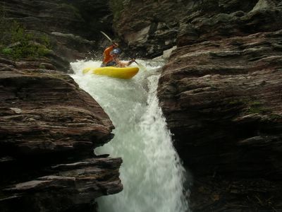


Below here two more short spaced drops remain within Drywood's canyon before it flattens out between a forest of Alder trees and finally bubbles down into a prairie stream.


View S. Drywood Creek (IV) in a larger map

Monday, June 06, 2005

Cataract Creek, AB - Canada

With the Rocky Mountain snowpack being minimal at best over the past few years the window of opportunity for Alberta creeking has been short and often disappointing. Again this year looked bleak with a snowpack which came and went out the backdoor. However since the beginning of June, a gift of torrential rain has been sent from afar from the Gulf of Mexico. In a matter of days arid Alberta was saturated coastal style and washed away are paddler's concerns of an unfulfilled season. With the gauges blowing past normal on local waterways, it is time to welcome back quality creeking to the Eastern slopes of the Rockies and get things done.


Hoping for a soft landing and some friendly boils off of Titan - Cataract Creek, Alberta. Posted by Hello

Cataract Creek is one of Southern Alberta's great local wilderness runs with good access and some quality drops found within. At the start you meander along an open creekbed for 5km until the valley narrows to the meeting of 2 mountain ridges. Just past a blind corner, the river constricts into a narrow box canyon. Here you will want to either scout or portage the two big canyon drops on river right. The one-two combo of Hercules and Titan falls is classic descent, however Hercules usually doesn't have a clean line until higher water. Titan can be ran at much lower flows by seal launching below Hercules.


Shown with a clean line (14cms), Hercules marks the entrance to the first box canyon with Titan falls just below. Posted by Hello

After exiting the first set of waterfalls, the creek runs through another canyon of class III rapids until Zig-Zag falls. Zig-Zag begins as a series of river-wide ledges before a 10 foot boof into another walled-out pool.


Touchdown off of Zig-Zag falls. Posted by Hello

Another 4-5km of class III+ and the river kicks right and ramps off into the Nasty-Notch, a narrow river-wide chute with walls on either side.


Michelle Basso charges into the Nasty-Notch and short box canyon section on Cataract Creek. Posted by Hello

The final push to the confluence with the Highwood river contains many more bedrock ledges and perhaps one of the largest rapids in Alberta. Class V Leviathan cascades over 3 large ledges before turning into a 50 ft. two-tiered slide and finally dropping into a massive hole. Even if you have run everything up until this point, most people take a really long look at this rapid before opting to portage on river left.

To get to Cataract Creek, head West on route 541 from the town of Longview following the Highwood river for 40km until you come to Sentinel recreation area. Here marks the confluence of Cataract creek and the takeout for the run. To reach the put-in, continue up route 541 for another 4km and then turn left onto the 940 forestry road and head south for 12 km until you reach the bridge. Good camping and an alternative put-in exist just beyond here.


Back to Titan for an October huck - Cataract Creek, AB Posted by Picasa


View Cataract Creek (III-V) in a larger map