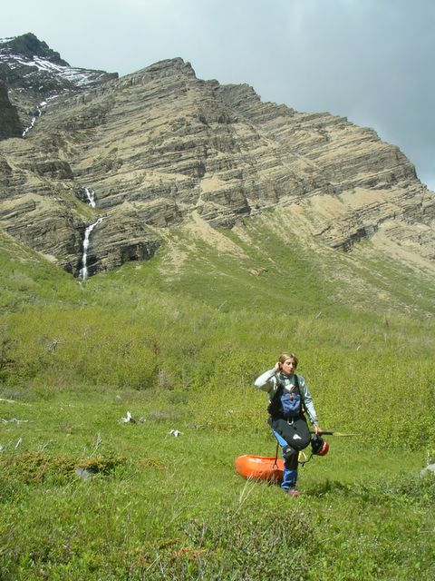
Spencer Cox sets off down South Drywood Creek, Alberta.
Photos courtesy of Chris Goble.

With the establishment of pipleine and gas-compressor access roads, the logistics for creeking in Alberta are ever improving. A little family history in the Southern Canadian Rocky Mountains and plentiful hiking routes has also helped in the discovery of some new creeking runs for those to explore. The North and South Drywood drainages have long been accounted for on the map, but only recently did their paddling potential become a reality. Located in the far Southwestern corner of the province near Waterton-Glacier National Park, South Drywood creek was a formidable discovery a few years back by paddler and Waterton local Chris Goble. South Drywood runs East towards the open grasslands, but not before flowing out of a spectacular alpine valley.
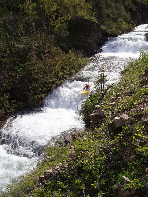
Michelle Basso winding her way through the Alder trees along South Drywood Creek.
If the gate is open (which is supposed to be the case after June 15) you can easily drive to the put-in and takeout on this run. However one can also make the 5km trek up the road in just over an hour which gives you early season access, optimal flows and a mountain valley all to yourself.
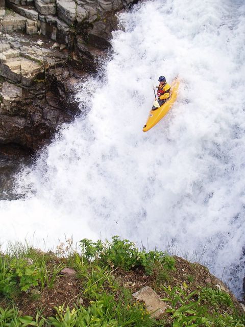
From the put-in, the creek begins with a beautiful 20 ft cascading waterfall into a tight pool.

After the entry falls, eddies become scarce as the run opens up for about a kilometer flowing over multiple cascading ledges, two of which are in the 7-9ft range.
Going with the flow until an eddy appears downstream.
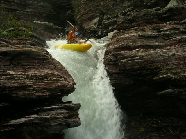
Once the red walls of layered rock begin to close in around you, start looking for an eddy on river right near the roots of a dead tree. Inside the tight canyon lurking below things begin to get vertical quickly as the creek drops into a narrow 20ft chute aptly named "Epi Pen".
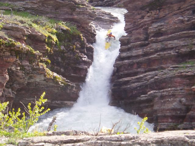
Epi Pen set amongst some awesome layers of red rock.
From the bottom of this pool the creek tears down a right banking slide and sets you up quickly for another very tight drop requiring precise left angle to avoid hitting the right wall at the bottom.
Below here two more short spaced drops remain within Drywood's canyon before it flattens out between a forest of Alder trees and finally bubbles down into a prairie stream.
View S. Drywood Creek (IV) in a larger map