Friday, June 16, 2006

East Rosebud Creek, MT - USA


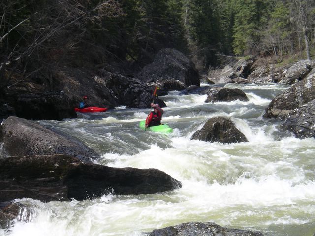
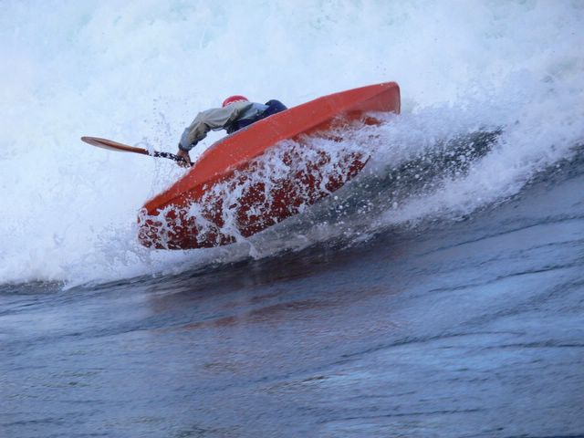
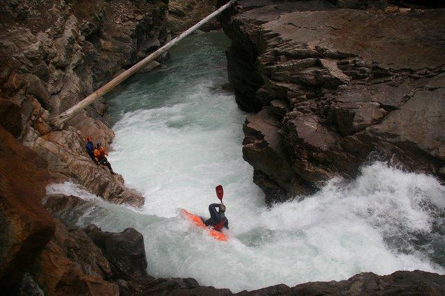
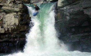
Kelsey Thompson on the endless white torrent known as East Rosebud Creek - Montana Posted by Picasa

High flows, snag-wood shores, strainers and a gradient of over 200 feet per mile might seem like a class V creek to walk away from. Other times it is best to follow through with your instincts, stick together with your friends, paddle like experts, and meet the challenge that lies ahead. If there ever is a creek to keep your heart rate at its highest throughout the entire length of the run, East Rosebud with around 2500 cfs coming out of the lake sits well in this category.
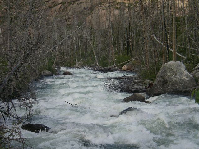

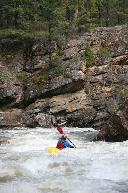
Essentially looking like the whole run....... Posted by Picasa

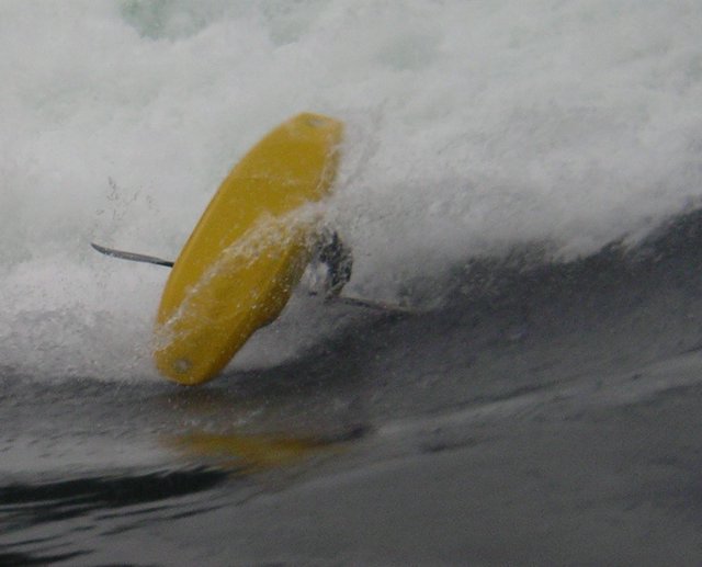
After Joey Vosburgh and Kelsey Thompson held a brief creekboat hole-riding competition near the takeout, we attempted to draw comparisons of a super stompin' East Rosebud with some other runs which we knew.


The tranquil outflow of East Rosebud Lake just before the chaos eruptsPosted by Picasa

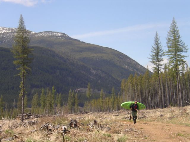
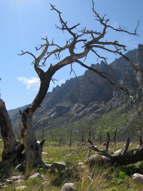
East Rosebud creek flows north out of beautiful East Rosebud Lake in the Beartooth range which borders Montana with Wyoming. In September of 1996 a forest fire started in the alpine and blazed out of East Rosebud Canyon and onto the front range. Today new tree growth is just beginning among dead standing trees which fill the valley. Along the river, the trees still standing look as if they are begging to be brought down by winds so that they too can join their friends resting along the banks.

Posted by Picasa

As we made our way up the road along the river left shore twice we found ourselves making strange faces and noises as we envisioned being caught up in the spider-web log jams within a raging torrent. Although scouting these spots before putting on was the ideal decision, there was no doubt the wood and high water played with our heads as we continued on. As we drove across the final bridge where a wide flat channel exits the lake, our conversations ended at the sight of which seemed to be too much water for something called a creek. Russ Fry, Nick Turner and Matt Wilson capture the feelings exactly in their Montana Surf guide book with quotes about East Rosebud like: "Putting in at serene East Rosebud Lake gives you a moment of clarity before the rush begins" and "this is as close to sword fighting as you are going to get in a kayak"


Posted by Picasa

If you are in the area, checking out East Rosebud is a must do. The road is nearly paved the entire way up and allows for easy scouting while you drive. The put-in for the run is straight out of the lake and finishes either at the bridge where the pavement ends or about 3/4 of a mile downstream from there. Depending on snowpack the creek flows throughout the early summer and runs longer thanks to a large drainage and lake support. Our decision to scout many corners on the way down was important for our first time but in no way did it prevent the action from feeling like anything but riding a white roller-coaster down a valley of sacred sticks.

Wednesday, May 24, 2006

Skookumchuck Creek, BC - Canada


Michelle Basso punches shot in the heart. Skookumchuck Creek, BC - Canada Posted by Picasa

Although Skookumchuck is the name most commonly referred with the playboating wave/tide formation on the BC coast, a fine creek with the same name also exsists on the opposite side of the province in the East Kootenay's. Skookumchuck creek flows steady during the months of May and June and provides endless technical class IV creeking in a relativley safe wilderness setting. This often makes Skook creek the place to go early season for those wanting to test their creeking skills before dropping into the harder runs in and around the area.


photo by David FaubertPosted by Picasa

It had been many years since I had returned to paddle Skookumchuck Creek, but with interior BC rivers coming up much earlier than our local creeks in Alberta, making the 3.5 hr drive certainly became worth it over a few weekends last May.

Few rapids on this run distinguish themselves as significantly harder than others. After 3km of flat water from the put-in, the river narrows and the gradient increases enough to make things more exciting but still very manageable. Look for two technical class IV boulder filled rapids in this section before things ease off again.


Mild but technical boulder gardens for 20km..... Posted by Picasa

Just beyond the second smooth weeping water rock face on river right, look for a few interesting drops which may or may not contain wood. Nearing the end of the run is "Shot in the Heart", a name given in Stuart Smith's guidebook. At most flows this rapid deserves a scout on river left, but essentially it is a boof through a narrow river-wide ledge hole. Setting safety is also very easy here.


photo by David FaubertPosted by Picasa

The best news about Skook Creek nowadays is the old but newly discovered shuttle road that goes partly up and over Lookout Mountain instead of around it. Thanks to some local boaters from Kimberley, this route cuts more than 20km off the rough and very long 40km Torrent/Skook forest sevice road. A link for the new shuttle directions is provided here.


Scott Feindel enjoys an easy new shuttle through classic BC clearcut. Posted by Picasa


View Skookumchuck Cr (III-IV+) in a larger map

Wednesday, April 05, 2006

Early season at Skooks, BC - Canada

Posted by Picasa
Tyler Curtis gets back on his Canadian playboating game at Skookumchuck - British Columbia.

Ingredients for a 5 day Skook mission from Calgary

1 truck with canopy
2 ferry rides
3 possessed kayakers
4 hikes in and out to the wave
5 bags of groceries
6 pm departure time
7 gas stops
8 am arrival time
9 minutes of sleep

This winter in Alberta the weather has been fairly mild and the skiing quite epic. But once late March rolls around, many of us find a need to make the transition from mountain ripping back on over to the search for steep creeks and big waves. A good way accelerate the wait for our local rivers to break free from their wintery hold is to make an 11+ hour roadtrip over to the green wet goodness of the BC Coast. This time our adventure could only be of the 5 day version, but our timing was ideal as we were able to hook up with Tyler Curtis and Mariann Saether for some of the first daylight Skook waves of the year.


Michelle Basso airblunt Posted by Picasa

This was Mariann's first time to Skooks and Tyler had not been around here since the days of the EZ. After some coffees and a parking lot fashion show display of some new paddling threads, our Skook crew along with some boaters from the Seattle area paddled out on a cloudy afternoon just as the tide was turning.

Posted by Picasa
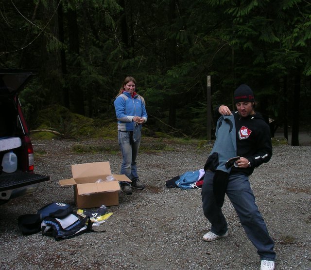
It's better than Christmas! Tyler and Mariann dig into a new box of paddling goodies fresh off the Greyhound express.

If you're still not in the know, Skookumchuck Tidal Rapids is a provincial marine park located on BC's Sunshine Coast about 2.5 hours from Vancouver including the ferry. This glassy tidal roller that forms for a 4-5 hour period once the tide comes back into Sechelt Inlet is now a frequent stop for many local and foreign paddlers. Summer months can sometimes get especially busy when tides over 12 knots begin flow consistently throughout the daylight hours. Camping around the area is easy to find. About 4km before Egmont harbour take a right and head up to Klein Lake Campground if the weather is nice. Another alternative is to camp or rent a cabin at the Egmont Marina Resort.


Although Skook can be a busy place sometimes these days, even a crowd of 20 paddlers can easily get dispersed and tired out which gives you more minutes on the wave than you might think. Still the early spring is when you might be able to find a special day on the wave all to yourself. Find Egmont B.C. on a map, then make sure the flood tide is 12-15 knots and that you're confident paddling in the squirrely water that boils up behind the wave.


Posted by Picasa

Check Skook's tide levels: Sechelt Rapids.

Posted by Picasa
TC, Michelle Basso and Sean Allen stop for a sunny break while hiking in for another session.

Saturday, November 26, 2005

Astoria River, AB - Canada


Scott Feindel setting up for the canyon entrance on the Astoria River - Jasper National Park, Alberta. Posted by Picasa

As we hang up the paddles and pull out the snowmobiles and skis here in the Great White North, one can't help but smugly reflect on a most interesting paddling season that was greatly enjoyed by many Western Canadian river rats such as myself. Expecting a lousy runoff due to mediocre snow pack, this was greatly altered thanks to a month of huge rains last June. The window of river running opportunity multiplied tenfold over the course of a few weeks and even to this very day, dams are still running at 100%. The water tables across the province of Alberta have never looked better.

One of the rivers that enjoyed an extended season is a Rocky Mountain classic located just outside the mountian town of Jasper. The Astoria has long been considered a special river among creekers past and present. Although it is not the sickest run in the West, a combination of easy access, pristine Jasper National Park wilderness and continuous gradient put the Astoria high up on summer tour schedules. Paddlers who know the Astoria routine and are confident running the final class V canyon can pull off a morning blast and be back on a Jasper patio sipping brews by lunchtime. From here, it is an easy drive west one hour to the classic big volume water found in the upper Fraser.


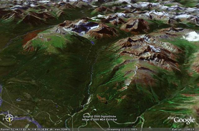
A satellite image of the Astoria River courtesy of Google Earth. Posted by Picasa

The Astoria would probably be a multi-day mission if it weren't for the paved road giving summer tourist access to Mount Edith Cavell and the hanging Angel Glacier. About 1km before the main parking lot at the end of the road look for the Tonquin Valley trailhead and park your vehicle here.


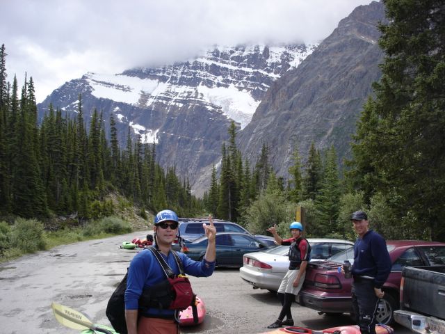
Gearing up at the Astoria put-in with Mt. Edith Cavell in the background. Posted by Picasa

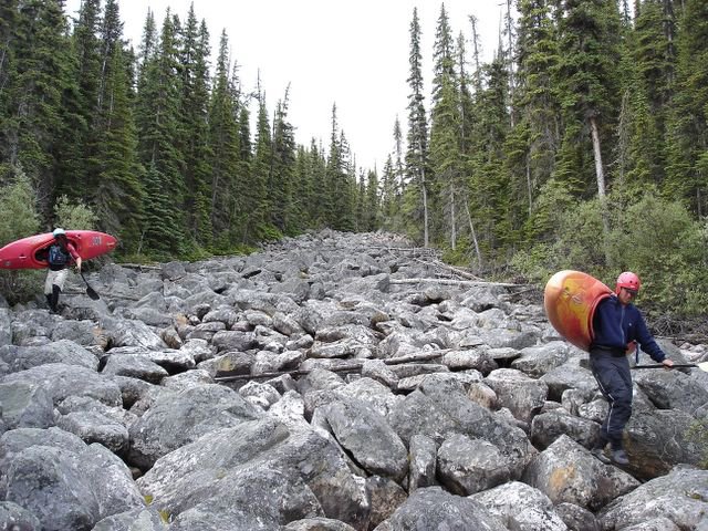
Follow a short stretch of the trail to the bridge that crosses Cavell Creek. You will only hear Cavell Creek as most of it now runs underneath a bed of large rocks which you will find useful to walk on. Head down the boulder bed and once the rocks lose their size and the creek reappears, move to the right shore and make your way through the brush until you encounter the calm meandering Astoria at the bottom of the valley.


Joey Vosburgh and Colan Morrow on their way down the boulders atop Cavell Creek Posted by Picasa

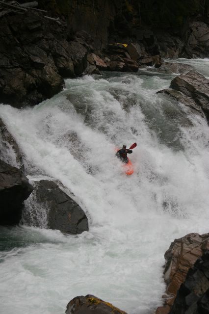
The Astoria will begin to take off in a continuous bed of boulders less than half a kilometer from the put-in. Depending on the flow, either there will be some bumpy sections or you will be wanting to space yourselves out as you begin to speed down a ribbon of white. Don't be too surprised if you can't find an eddy able to hold more than one kayak. If the water is high you will find yourself in an endless but manageable torrent of whitewater bliss making lots of quick technical moves and hopefully keeping your kayak pointing downstream. After about 5km, the river becomes even steeper and it is time to begin looking for a steep left sweeping turn that ends in a sharp right corner at the canyon entrance drop known as the Howler. You can get out on the left well above this section and walk down to the entrance of the canyon to scout. If the canyon entrance drop looks really nasty, this short but intense canyon will contain several very difficult lines including a river wide hole located just downstream of the entrance.


Scott Feindel keeps his speed through an unpredictable hole downstream of the canyon entrance. Posted by Picasa

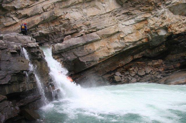
A bail out option is to head up the river left slope and portage the entire canyon. This option is not as bad as it looks and can be done in less than an hour. The canyon ends in a beautiful pool backed up by a small diversion dam perched on the edge of an unrunnable walled waterfall. Carry your boat down the dirt road and you will come to the main road and bridge that crosses over the Astoria. If you haven't had enough you can put back in and run 3.5km more of the Astoria as it flattens out into grade II before joining with the Athabasca River Valley.


Looking downstream from the take-out at the crazy rapids below the diversion dam. Photos courtesy of Jordie Mckenzie. Posted by Picasa


View Untitled in a larger map

Tuesday, October 18, 2005

Spillimacheen River, BC - Canada


Raymond Schmidt gets a close-up of the last drop, Spillimacheen River - Canada
Photos thanks to David Faubert. Posted by Picasa

The Spilli is the paddler's answer for a class V fix long after most creeks in Southeastern BC have gone into winter hibernation and are ultimately dry. The upper reaches of the Spillimacheen River begin deep within the Dogtooth Mountain Range, famous for winter backcountry snow greatness. Of course once the snow turns into liquid form, it creates abundant water levels throughout the summer. Most of the steep goods lie within the final 2.5km gorge just before the Spilli's final run out into the Columbia River basin. In such a vast BC watershed it is no surprise that a hydroelectric plant was also created in this high gradient section of the run. Fortunately it is the amount of water being diverted that makes late autumn water levels perfect for running possibly all several drops within.


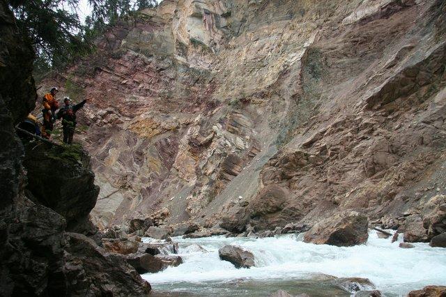
Nice geology and some tight lines as well. Posted by Picasa

It used to be hard enough just to piece together a group of boaters in Calgary looking to run the shit only a few weeks before winter officially arrived. Yet my phone found a way to make it happen. An early Sunday morning drive found Spencer, David, Ray and I heading over the continental divide into a significantly warmer Columbia Valley. Thankfully creeking was still on the agenda mid October in the Rocky Mountains.

Once you are over the dam spillway and into the canyon, you quickly realize how fortunate you are to be able enter this committing stretch with just the right amount of water. The rapids begin to come quickly in succession and on the second drop you face a tight line putting you onto a slide that ends in a funny hole. Out of this drop begins some great boulder gardens with plenty of lines to lose yourself in.


Posted by Picasa

The next significant stage of the Spilli is when the boulder garden narrows and finishes in a nice ramp drop. This drop requires making a tight line just above the rapid between two big boulders that may have pin potential. Beyond this you enter the heart of the gorge with two drops aptly named the "pink" and "stink". Most of our crew decided to only run the top drop and probably made a wise decision as I personally found out how stinky paddling into an L shaped drop with a viscous hole and no hull speed could be.

Posted by Picasa
Good safety was a good thing dropping the Stink.

Upon getting around the stink, all that is left in your way is a beauty 15 foot waterfall to seal the deal and send you floating down to the take-out bridge.


Spencer Cox goes right line off the falls. Posted by Picasa

The Spillimacheen River is located about 50km south of Golden BC or 35km north of the town of Radium on route 95. Take a left onto Westside road once you reach the settlement of Spillimacheen and then continue 2km until a right turn onto the Spillimacheen Forest Service Road. From here the take-out is your first bridge crossing and the put in is another 3km upstream on the left at the reservoir.


Vis Spillimacheen River (V) i et større kart