Monday, June 11, 2007

Big Timber Creek Race 2007, MT - USA


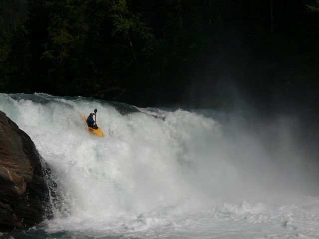
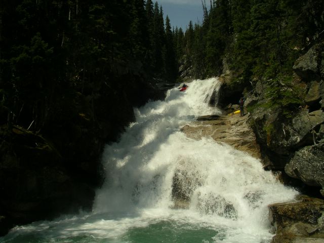
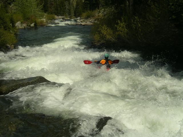
Bryce Shaw airbrace to switch - Big Timber Race -2007

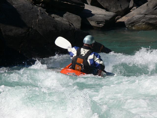
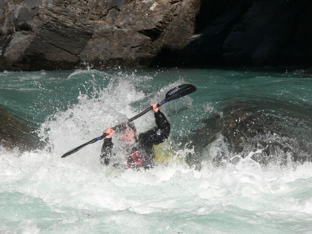
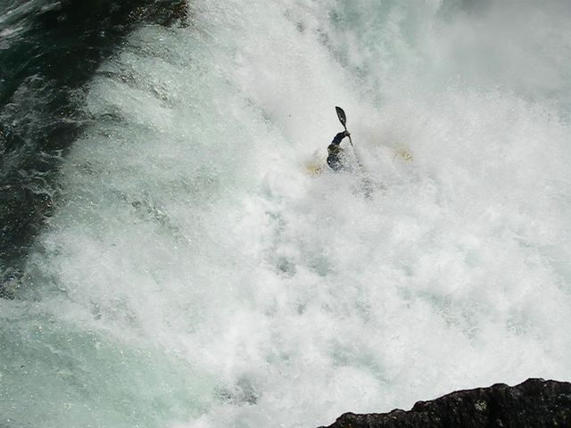
The first ever Big Timber Creek Race took place over the weekend with over 30 competitors stepping up to fire off one of the steepest sections of downriver racing on the whitewater map.

Special thanks to race organizers from Headwaters Paddling Association, great sponsors, landowners in the area and everyone who came to rage down Big T any which way they could.

Pinch Runners Results:

1. Chris McTaggart
2. Mikkel St. Jean Duncan
3. Spencer Cox
4. Ira Vasgaard
5. Patrick Rodgers
6. Mark Basso
Logan Grayling
8. Bryce Shaw
9. Doug Marberg
10. Bradford MacArthur
11. Chris Baer
12. Graham Storey
13. Chris Newey
14. Todd Richey
PJ Moran
16. Cooper Brightman
17. David Binkley
18. Aaron Loft
19. Barry Bohr
20. Will Hartman
21. Matt Sylvester
22. Chad Wiebe
23. David Schroeder
24. Steve Rodgers

Gamblers Results:

1. Andy Hoover
2. Ian M
3. Jeff Lessley
4. Jeff Clark
5. Randall Cook
6. Jonas Grenz
7. Jason Matthews
8. Mike Goglin


Big Timber report from last year's mission:
___________________________________________________________________

In the constant search for the backyard dream run it was most excellent to come upon a classic steep creek which actually does exist within a tank of gas from the house. Like the classic slides of California, Big Timber Creek is also proof that you don't need to travel all the way to Norway to get the super slide kayaking fix.


The Pinch.

Flowing from a fairytale backdrop with a gradient of over 700ft per mile, Big Timber is certainly a short run of epic scale. The Crazy Mountians simply rise up from a portion of Montana prairie like an oasis of rocks. Our Calgary crew of 3 strode across into Montanada with high hopes of dropping into slide infested Big Tim upon arrival. However while discussing flows in Bozeman with the Garcia brothers our conversation became flooded with talk of too much water. Only the week before, high elevations in the area were still receiving snow and now all of a sudden Bozeman was back to mid 80 degree temperatures. Only a couple days before Evan and Ian had mixed results on Big Timber's lower falls at high water and were sent home with a black eye and roughed up hands.


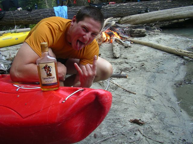
Posted by Picasa Found some wood.

We decided to put our Big Timber anticipations on hold until later on in the week and instead headed over to the Stillwater and Boulder creek drainages. Both of these areas were also seeing a sudden purge of snowmelt but fortunately the only carnage we saw came from Joey bagging his Toyota on the back roads.
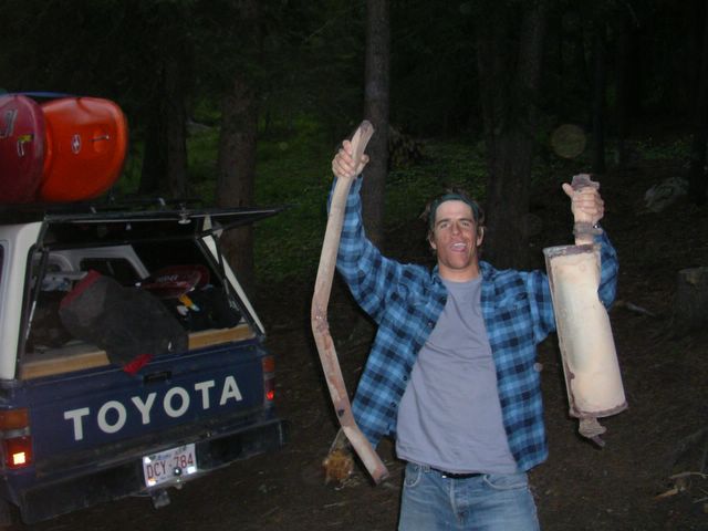

Hung up like a fresh kill....Joey Vosburgh post muffler. Posted by Picasa

On the eve of moving on from the Sawtooth Mountains and heading over to Missoula, we sat in the Columbus truck stop looking at the map and decided that Big Timber was just too close not to at least go camp at and scout the next day. In the morning we awoke at Halfmoon Campground to the sound of the water romping below our trucks. Coffees in hand, it took only a short walk up past the lower falls to commit to paddling the creek we had drove the 500 miles to claim. By local standards it was high, but indifferent to customary knowledge, we still saw plenty of eddies on the hike up and quickly began recognizing some of the drops from films and photos.


Chris Baer on the first drop.

Big Timber Creek starts off with one of its few near vertical drops on the upper section before turning into slide-pool slide for a majority of the gradient. Most of the slides are steep enough to make you forget about the abuse your creeker's hull is taking and a couple long slides put you near the euphoric state of creekboat bliss.


As our afternoon wore on we realized we weren't the fastest on the way down and a long scout of the 70 ft super-slide pinch near end began to make us wish we had brought more than a few energy bars. After running the pinch, the last few drops put us on the brink of underperformance and we decided to come back another time to run the lower falls.


Jordie MacKenzie - Lower Big T Falls July, 06


Unless you are one of the lucky Bozeman/Livingston Boaters who get to spend countless hours of worship sliding out of the Crazy Mountains during the snowmelt, hardly enough acclaim can be given to Big Timber Creek off a quick road trip. As always for those who appreciate summer in Western North America, Montana beckons……

Posted by Picasa

Thursday, May 24, 2007

Cameron Creek, AB - Canada


In the goodness of Cameron Creek, Alberta - Canada

Cameron Creek and his rookie status remain fairly static due to the remote yet accessible Alberta prairie-mountain zone where the number of National Parks outnumber the representing creekboaters. In fact if this quaint little tributary of Waterton Lake was situated a few miles to the south in Montana, perhaps the run would have a greater reputation from the western boating community.


Nevertheless for a run located in the far southwest corner of the Canadian Rockies, Cameron Creek will remain a roadside playground for those looking for quality drops under looming windswept peaks and canyon walls.


Keeping the hands away from Razor Ramone

Over the past couple of weekends Cameron has been dubbed 'creek of the week' by a select few who have been keen to run BC class V but ultimately have been shut down thanks to record snowpack melting in the hot spring sun. Although creeks in the East Kootenays and Idaho panhandle have been chugging since early May, the other side of the mountains in Alberta have seen water levels remain consistent.


If you're coming from any direction to paddle you will still have to cruise the open prairie landscape until you see the mountains rise up out of nowhere. Waterton Park has only one entrance and you also will need to pay the national park fees. Once you near the townsite look for a quick right turn that steepens up a set of switchbacks. On the second switchback (nearest the canyon) pull over and have a look at unrunnable Cameron Falls. Here the creek makes a final plunge to the valley floor off an immense slide shelf in ugly fashion. After the switchbacks you will see a pullout on the left overlooking the canyon. If you are doing the main run this will unfortunately be your steep heave-ho takeout up a mixture of scree and bush.


Shon Cottrill finishes up Aldridge.

Continue driving another 6km up past McNeally's picnic area where the creek looks mellow. Another pullout on the left overlooks Aldridge. Put in here and have a good look at this rapid as it contains a couple of tight moves around some piton rocks at the top. If Aldridge looks scary, you might best reconsider paddling that day or at least go for the Cameron 'light' section. Beyond Aldridge is gentle 5 -1o minute float until the river turns right and enters the canyon. Once horizon lines start to appear be on the lookout for Wild Thing and scout on the left. Wild Thing rocks of a double ledge before turning into a sweet slide and might be the best drop on the run.


Just downstream is another double ledge within tight walls. The line is straight forward but is best scouted from the road on the way up. Hanging out in this pool below requires the decision of calling it a 'light' day and taking the easy hike out or getting the full Cameron admission. Not far below in the lower canyon is a committing cave drop that needs medium or lower flows. Look for a hard scout left wall just above a 20 footer with most of the flow going into a doom-room. Safety can be set up on the ledge that creates the cave but it will be in the hands of the first boater to style things up right. Watch for a log spanning the creek just below this and portage carefully.


Mikkel St. Jean on the crux cave drop

Once you are out of this mini box gorge the valley gets deeper but the road remains accessible high above on river left. Cameron Creek becomes the most fulfilling at this point as another half dozen crystal clean drops present themselves for more smiles and friendly hoots.


At the end is Razor Ramone, an ugly horseshoe ledge with a rock fin parallel to the line. Takeout above or below this rapid unless you are feeling like another go at tougher drops and scary portages for the final several hundred meters up to the brink of Cameron Falls.
Special thanks to Shon 'Flex' Cotrill for the snaps.


Map of the Waterton area


View Cameron Creek (IV-V) in a larger map

Monday, May 07, 2007

Findlay Creek, BC - Canada


A fine start to paddling season on Lower Findlay Creek - BC

If you have just spent the long winter digging out, skiing big lines, or just buried and hibernating under 10 meters of snowfall since last October....creekers from the motherland rejoice! This year's snow pack is MASSIVE and currently the Selkirk, Monashee and Rocky Mountain Ranges look stocked with a water supply certain to last through October. This doesn't even include the always representing BC Coast Mtns also spouting record amounts in new paddling frontiers like Terrace and Smithers. The past weekend brought a combination of skiing some of the finest powder of the year along with the resurgence of quality creeking back in the Columbia trench.


The final flush on Findlay Creek brings back memories of Cali

Findlay Creek has a special significance in that if it wasn't for a small mountain in the way, Findlay would actually be the headwaters of the continental Columbia River. Instead Findlay is one of the tributaries to enter the Kootenay River before it heads south into Montana. Things to take note about the East Kootenays and Findlay area in early May include: - Huge populations of Elk and Deer grazing this time of year, the excellent lush meadow camping everywhere, and the fact this run will be well blown out for most of the summer as temperatures increase.

The put-in for Lower Findlay creek is 5km up the Findlay forest service road at Findlay Falls Rec site. The camping here is excellent and is a base for paddlers who might alternatively paddle Skookumchuk or Dutch Creek. Just past Findlay Falls take a left turn on Skookumchuck forest service road and look for the power line road on the left which will take you to the takeout.

From the put-in a short trail leads down to Findlay Falls. This drop had a runnable right line in the past but has since become a logjam. The left main line of Findlay Falls is plain nasty at best.


Findlay Falls lands on a big choke stone.

As our crew of 3 departed with a slight hungover haze under the noon sun we were instantly surrounded by canyon walls and swirly currents. After about 2+ kilometers of clear water and two notable drops, the run tightens up and picks up gradient. Two narrow pinches lead you to a third boof-pinch aptly named the Portal. Set between vertical walls and a difficult scout, the Portal would certainly be a gauge (if it hasn't already)that high flows on this run would mean bad news.


Portal at low flows


After the Portal things really start rockin out with more drops and more consequences if you flub the boof strokes. Shortly after this section our group downsized due to a bruised rib but we were fortunate to find an exit climb out on river left for Colan and his boat. This left Jordie and I to tackle the crux of the canyon where the gradient goes off through a mess of scary sharp limestone.


In the steepest section a 200+ yard torrent requires a hard left cutback through a knuckle dragger's delight followed by a big launch off a pourover of chunky boulders.


Nailing this line would be the climax on the run if it wasn't for the surprise waiting just downstream of the big pool. The guidebook loathes about the wood in this previously unrunnable final ramp formed from a landslide on river right. Presently there is no wood to be seen and was first fired off by Scott Fiendel and I on last spring's mission.


Scott Fiendel on the final drop in 2006

The approach to this Kaweah-Cali drop is best done hard left with your foot on the gas until you punch a hole and enter the slide. From here Findlay Creek bubbles down until it joins up with the Kootenay. The best view is looking back upstream on the float out absorbed in those class V emotions. Here's to another epic summer in whitewater paradise. Props to Colan for remembering his 100 dollar camera on this trip.......sorry about the quality.


View Findlay Creek (V) in a larger map

Saturday, September 23, 2006

Upper Fraser River, BC - Canada


Left line off Overlander Falls - Upper Fraser River, BC - Canada. Posted by Picasa

BC's longest river has a record much entwined in the history of British Columbia. For centuries native peoples, traders, explorers and settlers have been bound to using the Fraser River corridor because of the essential route it provides through the mountains between the Interior and the Coast. The upper portions of the Fraser River were first encountered in the late 1700's by hardened explorers Alexander Mackenzie and Simon Fraser. It was Simon Fraser himself who in 1808 followed a large portion of this uncharted river to its mouth. After many months in the wilderness he reached the Ocean discovering that the Fraser wasn't part of the Columbia River system.

Today the main flow of British Columbia's largest watershed is one of the last major rivers in the world still running its course free of human interference. Although this doesn't include many tributaries forever changed from hydro projects, the main flow of the Fraser has never been dammed.


Posted by Picasa

To really locate the classic whitewater of the Fraser however, you must make your way across the province near BC's border with Alberta. Here in the wilderness of the Northern Rocky Mountains, the Fraser headwaters slowly begins to grow from its own remote valley in the heart of Jasper National Park. Most people will encounter the Fraser when it begins to follow a classic stretch of the Yellowhead highway. After Moose Lake, the river begins to pick up gradient and offers the best whitewater. Roadside scouting and access to a couple of sections are along this route.

The most popular 9 km pipeline to Robson Meadows campground stretch is world class by means of its continuous challenging whitewater, unsurpassed beauty, and extra long paddling season which extends from April thru September. If you increase the run about 5km longer near the outflow of Moose Lake, you will spend a day paddling consecutively up the scale of river difficulty from class I thru IV.


Posted by Picasa Patch Bennett in the mix of outhouse rapids.

Not far below the pipline put-in you will know you have arrived to the start of the continuous whitewater once you pass a small outhouse style shack just as the river turns sharply to the right. Here the river creates outhouse rapids followed by the infamous Eric's hole. At certain flows this continuous class III boogie water can quickly grow in size and create a number of class IV rapids just downstream. A few pourovers are always capable of administering good beat downs if one is caught sleeping at the wheel. Holes, waves and a few great boulder gardens all create lots of technical moves but still provide good times for those in their playboats.


Posted by Picasa Jen Spragg in the Canyon.

Near the end of the pipeline section is the misty horizon line of Overlander Falls. In September it is amazing to see salmon below this waterfall who started nearly 1000 km away in the Pacific Ocean. Fish who reach this point are now at the furthest point possible to spawn. Overlander Falls takes the entire flow of the river over a single ledge therefore the height seems to vary from 20 to 30 feet depending on water levels.


Posted by Picasa

A big volume left line is always there but puts you quite close to an undercut wall. Going right means taking a bump off a middle shelf before landing in the clear at the bottom. The remaining 2 kms constrict through a class IV (V) canyon with some more great rapids before ending in a giant pool. Here at the takeout, a perfect campground awaits you in the shadows of Mt. Robson.


Posted by Picasa

To get a detailed description of the Fraser River and learn more about the Fraser River Festival and some classic creeking nearby, checkout Sean Allen's and Spencer Cox's Kayakwest website.

Also check out the Fraser Flows (Fraser River at Red Pass).


View Upper Fraser River (III-V) in a larger map

Tuesday, August 08, 2006

North Stein River, BC - Canada


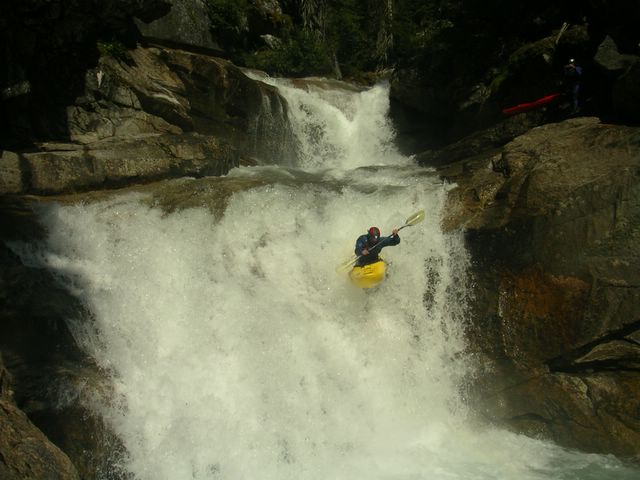
Jordie McKenzie drops a backcountry bomb on the North Stein River, BC - Canada Posted by Picasa

Since the beginning of backcountry river exploration in BC, the few paddlers who ever got to run the entire length of the Stein Wilderness had to do so by getting a solid group into Stein Lake headwaters with the assistance of their wallets and the Whistler Air Service. This all changed however in 2003 when David Norell, Braden Fandrich and Corey Boux first attempted to access the Stein River Valley with only their boats, a map, sleeping bags and plenty of ambition.


Posted by Picasa

After coming out from the mosquito abundant bush days later their infamous journey quickly turned into a much talked about adventure among their paddling friends in Western Canada. Their story about the trip was later published in a paddling magazine and the tales of the cheap dirtbag route became a classic and inspiring river story for anyone looking for a new BC multi-day mission. Best of all, not only did the trio of core-boaters save themselves more than a grand in plane fare, they discovered that the mandatory access tributary happened to drop 1800 feet over endless runnable slides in the last mile and a half. It was this discovery now known to a few more including myself as the very special North Stein River. Of course no tale on paper really can describe just how much hell is sometimes needed to find that piece of heaven you're searching for.


Chip Powell eats up the gradient on the final mile of the North Stein. Posted by Picasa

After 5 weeks of twice a-day creeking with fellow wingman Jordie "two boats-a-month" McKenzie, we ran into Braden Fandrich and quizzed him on our logistics of heading into the North Stein a week later. With our plans and route confirmed, I returned to Calgary to grab back-yaks, more beer and the unemployed and always smiling Chippy Powell as a third leg also keen for some vacation from hell training.


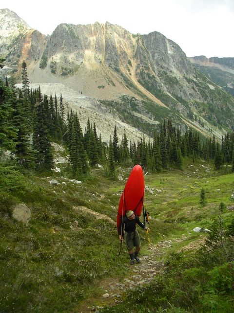
Just two Alberta dirtbags and an immigrant who can't afford a floatplane. Posted by Picasa

Once back at the Stein River take-out our adventure began with an afternoon drive out of the arid Fraser River Canyon and into a much cooler Coast Mountain Range. Pavement became dirt which became rock and overgrown trees on dirt track. Eventually the road came to an obvious end at 6000 feet with still plenty of elevation needing to be gained on foot. With majestic peaks surrounding us the enormity of the task of carrying nearly 100 pounds further into the unknown began to take effect. Just as final words of uncertainty were being uttered from our gracious shuttle driver Jenny, she watched her man Jordie take an epic nosedive down a steep slope out of view as we departed with loaded kayaks and the rest of the week’s adventure on our shoulders.


She's just over them there hills.....Posted by Picasa

Nearly three hours later we camped near the highest point of our climb and shivered the night away hoping tomorrow would be easier on our body and mind. The following day we walked through beautiful open meadows while constantly swatting the mosquitoes buzzing our heads. As a finale to our journey on foot we dropped down a steep wooded slope while chasing our boats into a maze of overgrowth and snags until the water appeared and rejuvenated our hopes. The North Stein at this point was still very far from being a river and the drysuits both Chip and Jordie were wearing began to be quite useful as our trio began hopping over numerous logjams on into the day.


All business after 6 hours of hiking. Posted by Picasa

Nearing the point where we thought more hell was being dished out than the amount of heaven we could ever receive, a treasure of gradient and big drops was found. We camped in the canyon only three drops into what would follow as one of the steepest river running days of our paddling lives. The morning of day 3 we crawled from our bivys and headed directly into what we had traveled so far to discover.


By the end of it all we had portaged only four times and ran more than a dozen slides and drops one would expect to find in the Sierras of California. The heaven meter had finally surpassed the hell.

Posted by Picasa


View North Stein (V) in a larger map