Thursday, July 28, 2005

Ula Foss - Norway


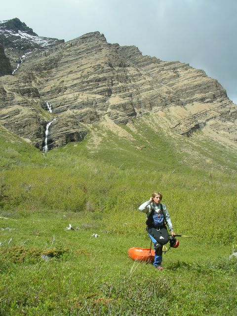
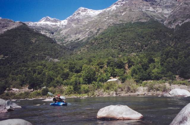
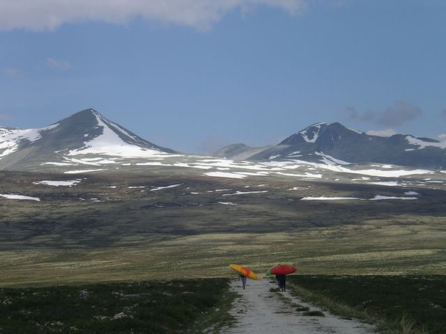
Walking to the put-in on the Upper Ula, Norway Posted by Picasa

The Upper Ula is a low volume creek containing the best of what Norway has to offer paddlers – amazing scenery, big slides and waterfalls, a little something for everyone. From the town of Otta near the Sjoa valley a steep winding road quickly climbs above treeline into Rondane National Park, one of Norway's classic trekking spots. Once the road turns to dirt, go left and pass through the toll gate and head further up the main hill covered by shrubs, goats and traditional houses with lots of grass on their roofs for insulation from the harsh winters.


Posted by Picasa

At the end of the road is a parking lot for hikers and a 5 minute walk will get you to the water.

From the put-in the first section is a nice easy warm up with some easy slides and drops to get you prepared for what is coming up. After portaging around a beautiful waterfall, the river enters a small gorge and starts to pick up in gradient.


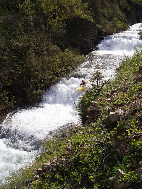
Kim Siekerman on one of the drops before the portage Posted by Picasa

Just past the end of the mini gorge comes two more significant drops before the start of the slides.


Jonothan Church on the second section of the Ula slides. (video)

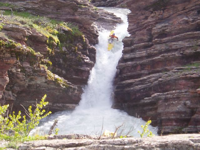
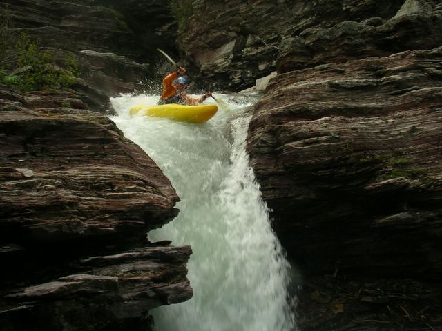
The slides are what most people come to the Ula looking for, here the creek drops over 2-3 slides more than 200ft long before ending in a sweet 15 ft waterfall. The line on this drop is tight if you want to avoid flying off the left side and onto a hard shallow landing.


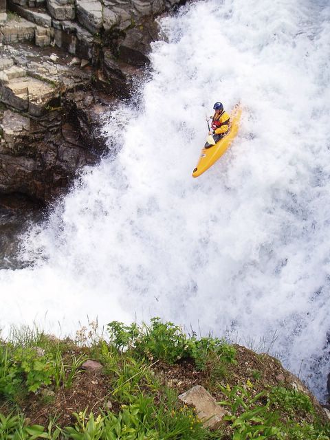
Airing out off the waterfall below the slides. Posted by Picasa

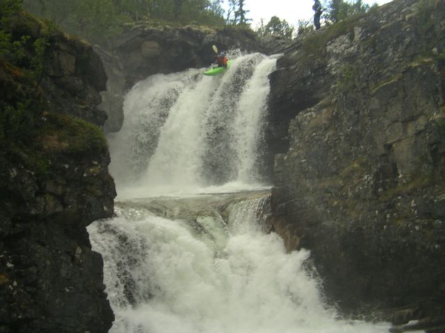
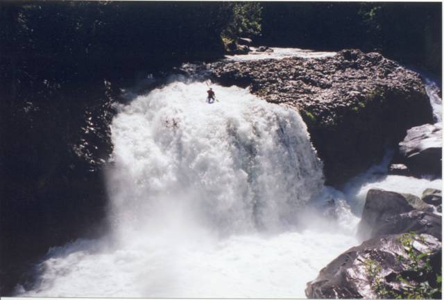
After the super slides the Ula resumes at an easier pace but still contains many small drops and slides before the run culminates at the four classic Ula waterfalls. The first 3 falls (20ft 7ft 15ft) are quite runnable at most flows while the last 40ft waterfall is rarely ran successfully.


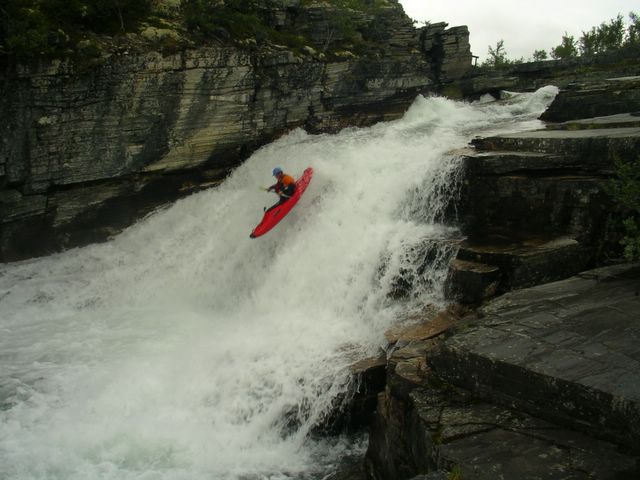
Classic Norway huckin'-Ula Falls, Norway Posted by Picasa

Just before the waterfalls is a road that will get you back to a lower parking for the take-out. Whether you come for quality slides, multiple waterfalls, or just to boof some fun drops in the alpine scenery, the Ula is certainly a Norwegian classic if you get it at a good water level.

Tuesday, July 19, 2005

Sjoa River - Norway


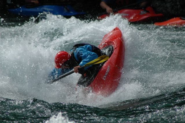
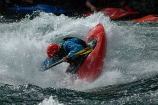
Michelle Basso blunts on the Jorgen wave, Sjoa River - Norway Posted by Picasa

-Report by Michelle Basso

58 hours of partying in New York, various train, plane and subway rides and we arrived unslept in Sjoa (shoo-a), Norway. We now had a couple of weeks to enjoy Norwegian hospitality and get in as much paddling as we could. The last leg of the train followed the mighty Otta river and judging from the water nearly lapping against the train tracks in some spots, we knew this trip was not going to be deprived of the quality h2o Norway is famous for.

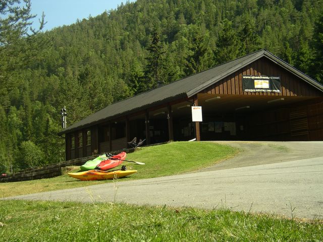
A great place to stay is at Sjoa Adventure, a fantastic kayak camp located at the Riksanlegget slalom center and operated by Aussie Brent along with Ed Cornfield, Kate Donnelly and Pete Astles from the UK. Here it's easy to party long into darkless night with paddlers from various parts of the world right next to the river. Riksanlegget camp also marks the take-out and put-in for two of the more popular runs on the Sjoa.
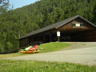

Sjoa/Riksanlegget Kayak Camp Posted by Picasa

Play Run – This is the section most often commercially rafted on the Sjoa river and contains the most play. This was our bread and butter run while we were at the Sjoa. The take-out was 20 feet from our campsite and it was easy to blast down it over a few hours. The play run is a class III section full of waves and holes waiting to be surfed. My favourite level was when it was high, but the best play features came in at medium-low flows.

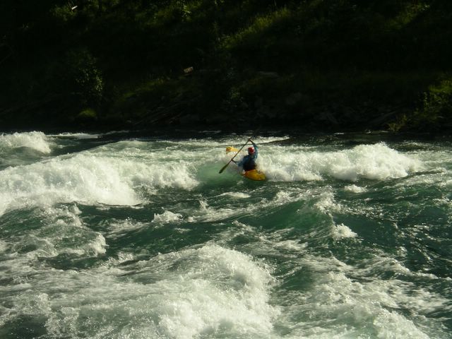
The Jorgen wave is the best-known play feature on the run and Mark and I were lucky enough to be there while it came in. It is easy to park at the Heidal Kajakksenter and walk down a path to the wave, so we spent many evenings playboating. Amazingly the sun set only for a few hours (dusk from about 12 to 2 am) so it was great to spend extra long hours on the river.


Jorgen Wave on the Sjoa River Posted by Picasa

Amot Gorge – Many evenings after Mark thought he had finished kayaking, somebody would come down to the campsite and ask “Do you want to run down the Amot?” If you knew Mark you know that he would never turn down some good paddling so off he went for his third session of the day. Again the put-in to this class IV+ section was right at our campsite shore with the take out only 3 km downstream. Amot starts off through the slalom course before heading into a beautiful and commiting gorge. At high water this was a burly slalom course full of Swiss slalom paddlers training in the huge waves.
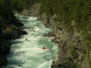

Pete Astles leading the way through the Amot Gorge Posted by Picasa

The Amot Gorge consists mostly of squirrelly water with large waves and holes to negotiate through. At high water the eddy lines and boils cause more difficulty than the actual run. After 15 minutes of non-stop action you reach the take out just above the confluence of the Otta river with a smile on your face, heart pounding, glad to have made it through right-side up.

Asengjuvet Canyon is located about 35km upstream from the Amot Gorge section and is another beautiful big water class III-IV canyon consisting of big waves and a few holes to avoid. We ran this 10 km section a few times enjoying it most at high water (the water level dropped about a meter during our time in Norway) as the waves were bigger and the rocks had more water covering them.


Posted by Picasa

Swimming was to be avoided on this section as the water was moving fast and there are a few S bends with undercuts. The hike out of the heart of the canyon is difficult if not impossible. We found out the hard way as a member of our group dropped into the biggest hole on the section and ejected from his boat. Luckily the boat and paddle were recovered about a kilometre down. To reunite with his boat our Finnish friend had to swim through some large class IV rapids and scale some cliffs. In the end everyone was okay and it was just another adventure on the river.

The Sjoa valley and the river which winds through it is a great place to start or base yourself from while paddling in Norway. There are 5 or more raft companies throughout the valley, a full scale kayak shop, small grocery stores and quality pub along the play run that gets busy on the weekends. From Oslo international airport (Gardermoen) you can either take a bus or train directly (3.5hrs) to the town of Otta which is only a 15 minute trip by car to the Sjoa.
Monday, June 13, 2005

S. Drywood Creek, AB - Canada


Spencer Cox sets off down South Drywood Creek, Alberta.
Photos courtesy of Chris Goble. Posted by Hello

With the establishment of pipleine and gas-compressor access roads, the logistics for creeking in Alberta are ever improving. A little family history in the Southern Canadian Rocky Mountains and plentiful hiking routes has also helped in the discovery of some new creeking runs for those to explore. The North and South Drywood drainages have long been accounted for on the map, but only recently did their paddling potential become a reality. Located in the far Southwestern corner of the province near Waterton-Glacier National Park, South Drywood creek was a formidable discovery a few years back by paddler and Waterton local Chris Goble. South Drywood runs East towards the open grasslands, but not before flowing out of a spectacular alpine valley.


Michelle Basso winding her way through the Alder trees along South Drywood Creek.

If the gate is open (which is supposed to be the case after June 15) you can easily drive to the put-in and takeout on this run. However one can also make the 5km trek up the road in just over an hour which gives you early season access, optimal flows and a mountain valley all to yourself.

From the put-in, the creek begins with a beautiful 20 ft cascading waterfall into a tight pool.


After the entry falls, eddies become scarce as the run opens up for about a kilometer flowing over multiple cascading ledges, two of which are in the 7-9ft range.


Going with the flow until an eddy appears downstream.

Once the red walls of layered rock begin to close in around you, start looking for an eddy on river right near the roots of a dead tree. Inside the tight canyon lurking below things begin to get vertical quickly as the creek drops into a narrow 20ft chute aptly named "Epi Pen".


Epi Pen set amongst some awesome layers of red rock.

From the bottom of this pool the creek tears down a right banking slide and sets you up quickly for another very tight drop requiring precise left angle to avoid hitting the right wall at the bottom.


Below here two more short spaced drops remain within Drywood's canyon before it flattens out between a forest of Alder trees and finally bubbles down into a prairie stream.


View S. Drywood Creek (IV) in a larger map

Monday, June 06, 2005

Cataract Creek, AB - Canada

With the Rocky Mountain snowpack being minimal at best over the past few years the window of opportunity for Alberta creeking has been short and often disappointing. Again this year looked bleak with a snowpack which came and went out the backdoor. However since the beginning of June, a gift of torrential rain has been sent from afar from the Gulf of Mexico. In a matter of days arid Alberta was saturated coastal style and washed away are paddler's concerns of an unfulfilled season. With the gauges blowing past normal on local waterways, it is time to welcome back quality creeking to the Eastern slopes of the Rockies and get things done.


Hoping for a soft landing and some friendly boils off of Titan - Cataract Creek, Alberta. Posted by Hello

Cataract Creek is one of Southern Alberta's great local wilderness runs with good access and some quality drops found within. At the start you meander along an open creekbed for 5km until the valley narrows to the meeting of 2 mountain ridges. Just past a blind corner, the river constricts into a narrow box canyon. Here you will want to either scout or portage the two big canyon drops on river right. The one-two combo of Hercules and Titan falls is classic descent, however Hercules usually doesn't have a clean line until higher water. Titan can be ran at much lower flows by seal launching below Hercules.


Shown with a clean line (14cms), Hercules marks the entrance to the first box canyon with Titan falls just below. Posted by Hello

After exiting the first set of waterfalls, the creek runs through another canyon of class III rapids until Zig-Zag falls. Zig-Zag begins as a series of river-wide ledges before a 10 foot boof into another walled-out pool.


Touchdown off of Zig-Zag falls. Posted by Hello

Another 4-5km of class III+ and the river kicks right and ramps off into the Nasty-Notch, a narrow river-wide chute with walls on either side.


Michelle Basso charges into the Nasty-Notch and short box canyon section on Cataract Creek. Posted by Hello

The final push to the confluence with the Highwood river contains many more bedrock ledges and perhaps one of the largest rapids in Alberta. Class V Leviathan cascades over 3 large ledges before turning into a 50 ft. two-tiered slide and finally dropping into a massive hole. Even if you have run everything up until this point, most people take a really long look at this rapid before opting to portage on river left.

To get to Cataract Creek, head West on route 541 from the town of Longview following the Highwood river for 40km until you come to Sentinel recreation area. Here marks the confluence of Cataract creek and the takeout for the run. To reach the put-in, continue up route 541 for another 4km and then turn left onto the 940 forestry road and head south for 12 km until you reach the bridge. Good camping and an alternative put-in exist just beyond here.


Back to Titan for an October huck - Cataract Creek, AB Posted by Picasa


View Cataract Creek (III-V) in a larger map

Wednesday, March 16, 2005

Rio Gol Gol - Chile


Caught in a summer snow near the summit between Chile and Argentina just upstream of the Rio Gol Gol, Chile. Posted by Hello

The Rio GolGol is another Chilean waterfall classic that majestically drains the valleys lying between Volcan Puyehue and Volcan Casa Blanca in Chile's Region de Los Lagos. This part of Chile receives an astounding amount of rain which means this section of the GolGol can often be too high. Navigable levels usually come in by January, but the water is sometimes low enough in December. This river has easy access as it follows the main international highway which connects Osorno Chile with Bariloche Argentina. If you are driving down to Futaleufu via the Argentinean route (as opposed to taking ferry in Puerto Montt) make sure you indulge in a paved shuttle road for a change and check this one out.


Starting off on the Rio GolGol Posted by Hello

From Osorno drive east on route 215 about 75 km until you cross the 1st GolGol bridge (possible camp spot) and then continue less than 5km more until the 2nd bridge. The 2nd bridge marks the takeout and the final waterfall on this section (Salto del Indio) thunders just upstream but out of view. From the 2nd bridge, drive another 10km uphill until the river is again visible. Here you will find a pullout for the Salto de los Novios waterfall and the Chilean border station is only a few kilometeres up the road. Salto de Los Novios is the first runnable waterfall and marks the beginning of the run.


Trip Jennings goes for the huck off Salto de los Novios. Posted by Hello

From the put-in the GolGol descends quickly through a typical Chilean lava basin in a class III-IV torrent until a broken ledge signals the next waterfall, a clean spouting 20' curtain. Below this you will come upon a nastier slide type drop that is separated by an island. The left side of the island is the cleaner line, but the right channel takes you to an easier portage. Continue on to drop #4, an easy slide boof that can be checked out on the right shore. Once you have cleared this drop there comes a grand-finale. Downstream lies the 30 foot GolGol classic that has a tricky lead in on river right with some serious undercuts on the river left shore. This 5th waterfall is hard to set up safety so scout carefully.


Good to go on salto number 5 Posted by Hello

Once you fly off this big bird for home the adventure still isn't over. A little more class III puts you at the brink of 40' Salto del Indio, now famous for being the highest waterfall ran successfully in a raft by Ben Stookesberry and Eric Seymour (see Chasing the White Demon). If you have had plenty of action for one day, Salto del Indio is easiliy portaged on river left and you can paddle the last bit of flatwater until the bridge.

Friday, February 18, 2005

Rio Los Sauces - Chile


Michelle Basso paddles past Cerro Maravilla on the Rio Los Sauces, Chile - November 2003. Posted by Hello

The Rio Los Sauces is a primary tributary to the more frequently paddled and equally beautiful Rio Ñuble, which crosses the Panamericana Highway about 400 km south of Santiago. Flowing West from where the last of the high Andean Cordillera parallels Chile and the Andacollo region of Argentina, the (III-IV) Ñuble and (IV-V) Los Sauces are certainly worth a paddle if you are in Chile early in the season. Both these drainages receive far less precipitation than the rivers and creeks of Pucon, therefore it is best to explore these runs during the Spring (November through December), when snow is melting.

The Los Sauces valley was discovered by kayakers a few years back when a new road appeared at the put-in for the usual Rio Ñuble run. At this grassy field where the road ended, a hanging bridge crosses the Los Sauces and you were previously only able to peer into the tight gorge upstream and wonder.

In November of 2003, Michelle and I were back in Pucon enjoying heavy rains and good surfing on the local runs. While we were there I met up with Nathan Sullivan, a Coloradan who spends half of the year paddling and living in Chile. I made a plan to meet up with him in a couple of days in the town of San Fabian de Alico on the Rio Ñuble, when he would be returning from Santiago with a friend who had just flown in. San Fabian is reached by turning East off the Panamericana in the town of San Carlos and driving 45km, only which of half is paved. Here you can purchase the very basic foods before once again needing to drive another 30 km on rough road that heads up the Ñuble valley. The road comes to an end at the hanging bridge on the Rio Los Sauces and just before, there are some friendly Chilean families who have lived in this valley for generations tending sheep. When we came back from a rainy day kayaking on the Ñuble, a farmer welcomed us in from the rainy night for some shelter and a friendly chat. The next morning the sun was back out and we all packed boats onto Nathan's van and headed up the recently made road. It took off steeply up the valley and above the gorge that we checked out the day before.


Looking down at the Rio Los Sauces from the van. Posted by Hello

After a few kilometers the road begins to decend back down to the open valley from which you can begin to see technical boulder gardens and generally easy lines flowing with crystal blue water. There is a good chance for some new exploration on the upper reaches of the Los Sauces, but Nathan and our crew put in during a flat stretch soon after the road gets very close to the river.


A quick S-turn rapid into a meaty hole also required some hard strokes to avoid the undercut river left wall. One of the numerous rapids scoutable from the road along the river right shore. Posted by Hello

Once the final canyon closed in around us we were forced to begin scouting and portaging a few rapids that were very ugly. At higher flows the canyon would become even more menacing. At the end of the canyon you will see the hanging bridge and a sandy beach take-out on river right. Here the Los Sauces opens up and flattens out until it joins the Ñuble 1.5km further downstream. The following day after Nathan and friends headed on South, Michelle and I could not help but stay an extra day kayaking and enjoying life up in this magnaficent valley.

Wednesday, January 05, 2005

Rio Cañete - Peru


Searching for rare whitewater in the Atacama Desert, Peru. Posted by Hello

For anyone about to begin a paddling adventure in land of the Incas, a unique and beautiful place to start is only a couple hours south of Peru's largest and overwhelming city. In February 2003, we decided to begin our South American paddling adventure rather unlikely from Lima, Peru. Flights from North America were cheaper and we heard it was also possible to purchase and register vehicles there. As it turned out, getting our kayaks on the plane was our worst problem and finding a van with little knowledge of Spanish was fairly lucky. However our registration process for our car was a very standard, yet an impatient 2 weeks was spent wondering around Lima. After meeting some new friends, we were surprised to hear that many people from Lima often vacationed in the small town of Lunahuana where camping and rafting trips were most popular. Sure enough, even our Lonely Planet guidebook spoke of quality whitewater found on the Rio Cañete. When our license plate arrived, the fuel tank was filled and we set off in our new home on wheels. Lunahuana and the Rio Cañete would provide a great introduction to the rivers and desert coast of Peru .


Lots of endless grade III - IV whitewater to be found on the Rio Cañete, Peru. Posted by Hello

The Rio Cañete(pronounced Can-yeti) flows from the Yauyos Cordillera of central Peru and on down through an arid desolate valley until it empties into the Pacific Ocean about 150 km south of Lima. Raging waters create a lush and temperate oasis along the river. This important climatic zone provides shelter, agriculture and local tourism all within a narrow landscape beneath barren desert mountains. River levels fluctuate in accordance to the wet and dry season of Peru' s high mountains, but the Cañete can be paddled all year long on certain sections. The upper reaches are technical and require low flows during June to September, but the lower Cañete provides excellent rafting and big waves in the high water months of January and February.


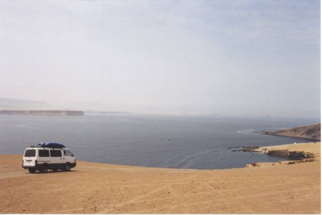
Sand meets the ocean in Paracas National Reserve near Ica, Peru. Posted by Hello

The logistics for getting to the Cañete are pretty easy if you are using the bus. One must head south from Lima along the Panamerican Highway about 150km until the agricultural town of San Vincente de Cañete. From there you will probably take a smaller bus 30 km to Lunahuana where you can arrange kayak shuttles with the local raft companies, find excellent food, and drink pisco in the desert heat. Check out Kurt Casey's website which provides more information about the fantastic upper Cañete creek run.