Saturday, October 30, 2004

Rio Apurimac - Peru

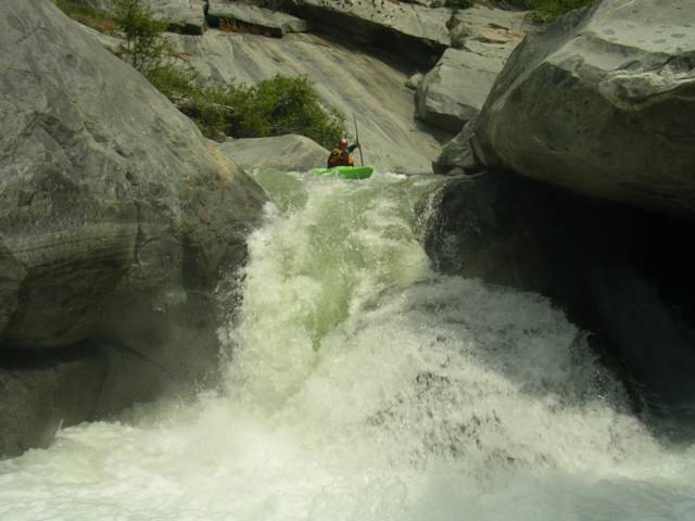
The Rio Apurimac is the source of the world's longest river, the great Rio Amazonas. Flowing North from a ridge of high andean peaks which separate its headwaters with the Rio Colca drainage, the Apurimac penetrates deep into the high Altiplano creating another amazing abyss twice as a deep as the Grand Canyon in the USA.


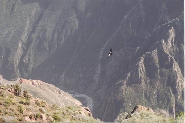
An Andean Condor soars high above the rivers which create the deep canyons of Peru. Posted by Hello

From Cusco, the commercially rafted section of the Apurimac is a convenient 3-4hr ride by bus and although the rafting trips take 3-4 days to complete, the length of the run is less than 40km and can be kayaked in two days. Basically the paddling season begins when the rains come to a stop in June (navigable high water), and ends in October (low water). Even if you haven't come to Peru with the main purpose of paddling, upon reaching Cusco, you will be amazed to discover that next to Machu Picchu and the Inca Trial, rafting the Apurimac is the next place of interest among thrill seekers from abroad. Although low safety standards do exist on a river with numerous class IV hazards and rock sieves, you can experience a 3-4 day raft trip down one of the deepest canyons in the world for less than 175.oo Cdn. As a recommendation, stay safe by NOT paddling "Dolore de Muela", a sketchy and long class V that for some reason Peruvians take their guests down until somebody dies!
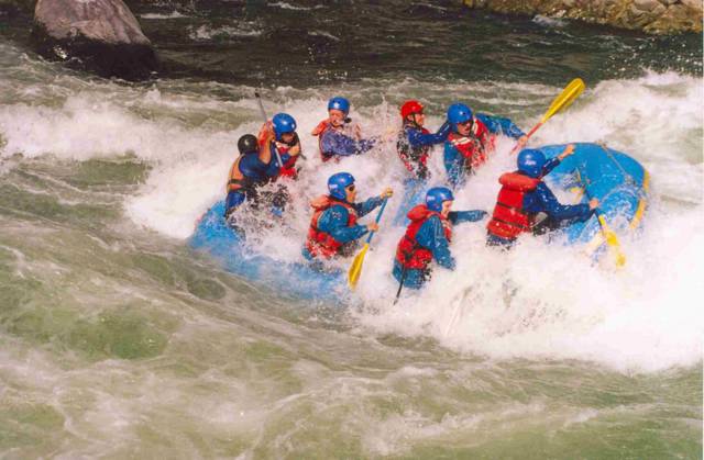

Another salad tossing about to happen in the Baticueva hole on the Rio Apurimac, Peru. Posted by Hello

When Michelle and I drove into Cusco in August 2003 with kayaks on our van, we were quickly confronted by Peruvian raft guides who were very informative and genuinley nice. Before the night was through I had been asked by Willy from Southern Rivers if I would like to safety kayak on his next Apurimac trip. After some negotiation (which included getting Michelle on the raft trip), I agreed and two days later we set out on another great adventure. This ended up being a 2 month job for me and by the end Michelle had also descended the Apurimac 3 times in raft and once in her kayak.
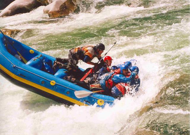

Willy from Southern Rivers guiding Michelle (red helmet) and the rest of the crew down the Rio Apurimac, Peruvian style! Posted by Hello

Before the Apurimac reaches the lowlands of the Amazon basin, it plummets down through the high Vilcabamba plateau and into the Abismo Gorge. The Abismo Gorge section begins directly after the commercial takeout at the town of Curahuasi where a new bridge was installed in the early 90's on the Abancay-Cuzco road. Still considered one of the most intimidating sections of river that one could find in South America, the Abismo gorge's window of opportunity comes in October when the water is at its lowest, yet only days before the start of the heavy rains and Peru's "wet" season. The late Russell Kelly of Ophir Colorado, having no fears solo kayaking inescapable canyons worldwide, ran the Abismo both in 2002 and 2003 with little time to spare before the rapids became unavigable.

Tuesday, October 26, 2004

Rio Cotahuasi - Peru


Three of the world's deepest canyons in Peru as observed by satellite. The rivers that created them are: Colca (top canyon), Cotahuasi (middle canyon) and the Rio Maran. The bottom right corner is the Pacific Ocean (white). Posted by Hello

Almost the same time a year ago, Michelle and I finished up working and playing in Cusco Peru, and began our long journey back down to Southern Chile. However before we left Peru for good, I was fortunate to be invited on a trip down the Rio Cotahuasi by Peruvian kayaker Gian Marco Velutino and Americans Matt Wilson, Damon Miller and the great Russell Kelly. While still debated against Tibet's Yarlung Tsangpo Gorge, the Cotahuasi Canyon at 11,550ft deep makes it one of the deepest canyons in the world. Only recently was the Cotahuasi accurately measured to be 500 ft deeper than the nearby Colca Canyon. Together along with the equal abyss of the Rio Maran which joins the Cotahuasi as the Andes come down to the sea, these three river canyons present incredible and committing paddling adventures to those who are willing to enter them.


The view of Cotahuasi from near the canyon rim. Posted by Hello

Our crew began our 11hr, 300km dirt road journey from the city of Arequipa, where the road climbs gently from the fertile Ocona valley up into the high Altiplano to well above 14,000 ft. As we passed between the white capped peaks of Nevado Coropuna and Nevado Solimana, the beauty and expanse of the Peruvian high desert gives one an awesome feeling. Yet just beyond these two mountains the road drops away to reveal an even more astonishing sight. The Cotahuasi canyon is so deep that even after two solid hours of descent by car or bus, we could still observe the road weaving back and forth far below us.

Once you arrive in the town of Cotahuasi, the river is still below but the Peruvian culture of the past and present surrounds you. Here you must make the necessary arrangements to find the rest of your basic foods, get another 5km down to the river, and have mules transport your boat and gear another 7km further downstream around the impressive Sipia waterfall. Below the falls, your long hike will get you back along the shore of the Cotahuasi. Once here, you can finally begin your 3 day, 65km class IV+ wind through the heart of an arid canyon still containing many Inca artifacts, graves and simple structures along the banks.


Peruvian children enjoy some new sights as Damon, Russell and the rest of us prepare for another mission on the Cotahuasi. Posted by Hello

The first decent of the Rio Cotahuasi was completed by Dave Black, Jon Barker, Jose Luis Lopez, Fico Gallese, Kurt Casey, Greg Moore, John Foss, Franz Helfenstein, Duilio Velutino and Gian Marco Velutino on June 4, 1994. Together as partners in expedition kayaking, Americans John Foss and Kurt Casey first descended a majority of rivers in Chile and Peru. Kurt Casey still spends his winters living in Chile and has created an incredible Peruvian paddling resource dedicated in memory of the late John Foss who pinned and drowned July 5th 1998 during the first descent of the Rio Huallabamba in Central Peru. For a complete description of the Cotahuasi and many more incredible rivers in the majestic country of Peru, check out www.peruwhitewater.com


Cotahuasi 2003: Russell Kelly, Michelle Basso, Mark Basso, Matt Wilson, Gian Marco Vellutino and Damon Miller. Posted by Hello

Friday, August 27, 2004

Slave River, NWT - Canada


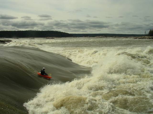
Molly's Nipple rapid at the Slave River. August 18th - 24th 2004, Michelle and I drove the ultra long (14 + 3 hrs) stretch of road between our home in Calgary and Ft Smith. This was my second trip to the Slave and water levels were about the same as in early August 2002. However on this later trip the days were becoming shorter the nights were a lot more chilly, which also meant no bugs! Although the Slave comes in as early as June, the bugs are beyond the comprehension of most people who haven't experienced life in the North. Beware in June and July! 

We left from Edmonton at 4am the next morning and rallied direct, stopping for a brief reunion at Alexandra Falls on the AB/NWT border with Almut Sohn and her two other German paddling friends. Germans were probably the most represented paddlers this year at the Slave. Despite it's reputation of having some of the most concentrated playspots anywhere, the Slave remained mostly free of camera toting big wave dwellers. Our other German friends included filmmaker Olaf Obsommer and Jens Klatt. Back after his source-to-sea Stikine River descent in 2002/03, Olaf is now documenting a broader range of western Canadian river and lake systems in his forthcoming film. We were fortunate to also meet up with Jesse Stone, John Fullbright and Yellowbird from New Mexico. A group of friendly Americans who always deserve a bout of regard for the monster road trip one needs to put together for coming to this place from the South.

   
Outrageous. 

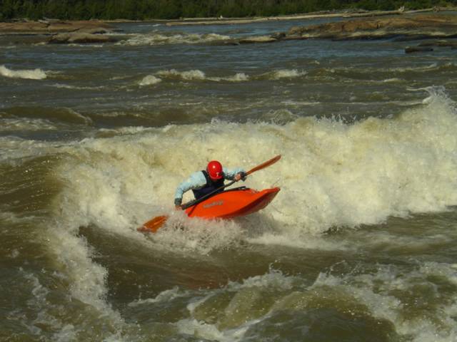
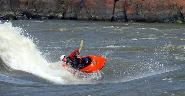
Anyways here is a shot of me on Roller Coaster at 3900 cms on the Ft. Fitzgerald gauge. The Slave is a majestical place that will scare you and inspire you. For detailed information on the Slave's rapids, check out Keith Morrison's amazing website with interactive satellite photos. Keith is the best guide you can ever have on the mighty Slave. 

  
RollerCoaster Air  Flows: 3000 - 4000+ cms Flow Gauge: Slave River Gauge at Ft. Fitzgerald.

Sunday, August 08, 2004

North Fork Dore, BC - Canada


Dore Valley Posted by Hello

The North Fork of the Dore is a challenging technical class IV-V creek that will keep you busy all the way to the end. We rolled up the Dore Valley (about 20 km off of Hwy. 16 and 25 km from McBride B.C.) to the confluence of the South and North Fork runs in the evening. Camping is good at the confluence but watch out for the cows in the morning if you don't hear them rolling through in the night. Next morning we set off another 13 km or so up the North Fork road until once again there is a bridge crossing the river. If you are charging this one beware of the Gnasher, a lengthy technical line that sends you into a powerful maelstrom of white. Jordie and I looked at a possible entry above the river right pour over and then decided to go for it.........


Jordie M. boofin' the Gnasher river right Posted by Hello

The rest of the run maintains a constant gradient until the final 3 km which is even steeper. Overall the North Fork of the Dore is worth checking out on one of those hot summer days if you are in the area. 2hrs from Jasper AB, 3hrs from Clearwater B.C.

For more logistical information on the Dore, check out Spencer Cox's Kayakwest website.


Vis N. Dore River (V) i et større kart

Thursday, August 05, 2004

Toby Creek, BC - Canada

Toby Creek's infamous seven canyon run is one of the best runs in Southeastern B.C. Draining the Toby and Jumbo glaciers, this run explodes into unrunnable levels many times throughout the summer. It is predictably high when heavy snow pack and extreme heat collide so know your levels or prepare for a hike-out that is a story in-itself. A good time is in August and even into September.

Although I'm sure there actually are seven canyons you paddle through, I like to think of the river containing: #1. Class III-IV technical whitewater up until, #2. "Juniors", a class IV-IV+ pinch with a revealing undercut ledge river-right.


Heather Armitage and the undercut before "juniors" Posted by Hello

After "juniors", the river picks up until the class V crux canyon containing #3. "Smitty's" and a NEW slide drop rapid (spring 2004) which leads up to "picket fences." If you are on the Toby at high flows this section will either be heaven or hell.


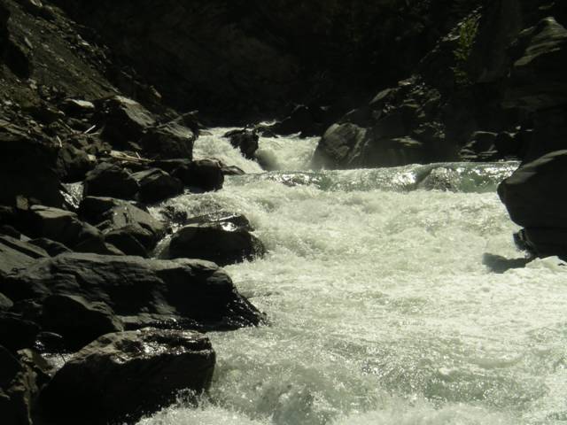
Looking upstream to the new slide drop and the entrance of "picket fences" Posted by Hello


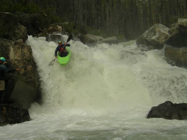
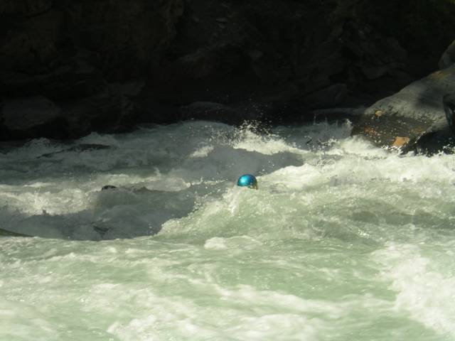
Jordie's sparkly helmet amidst the "Picket Fences" Posted by Hello

Just before you think it is over, #4 the seventh and final canyon has NOW CHANGED (spring 2004). This section is still long and constricted. Instead of the traditional river left scout, eddy out on the river right where a new gravel bar has formed to check this rapid out. Once you're through this the river flattens out.

Location: Invermere B.C. (road to Panorama Resort is put-in and take-out)

Friday, July 16, 2004

Beauty Creek, AB - Canada


A 25 minute hike up from the highway. Joey Vosburgh, Jordie MacKenzie, Dave Manning and Mark Basso gear up on Beauty Creek in Jasper National Park.

Beauty Creek lies hidden along the endless chain ridges which parallel the Sunwapta river near its headwaters in Jasper National Park. Fortunately this long mountain corridor between Banff and Jasper National Park also contains the main highway 93 which by summer months, offers easy access to the beautiful scenery and receives many visiting travelers. It is also during these long-awaited days in late June when kayakers begin to pass along the road in search of some excellent paddling runs in the Central Canadian Rockies. Although the runoff window for Beauty Creek is small, there are now annual visits to this short but intense alpine creek consisting of 8 major waterfalls and slides, 6 of which have been run.


25 ' Lumbarsis creates drop number two on the run.

Beauty Creek was probably first explored by known paddler Stuart Smith back in his days as a local Jasper raft guide. During these long Summer months more than a decade ago, Stuart made valiant attempts seeking out rivers in the Central and Southern Rockies. Since those days, local and foreign paddlers alike now use his guidebooks as a popular source of paddling information for over 200 river runs in B.C and Alberta. A while back Eric Link and the Twitch crew paddled Beauty Creek with extremely low flows, breaking a couple of boats on the way down. Check out 2002's Twitch TV for some good scenes.


Slanted slopes of the Endless Ridge Chain found near Beauty Creek in Jasper National Park. Posted by Hello

From the heart of Banff National Park, the scenic Banff - Jasper Icefields Parkway (route 93) begins in Lake Louise. From Lake Louise it is a 120km drive until you reach the Sunwapta Pass and begin a northerly decent past the Athabasca Glacier and Columbia Icefield Center. About 15km from the Icefields Center, a flat valley opens up and and it is time to start looking for a marked pullout and a small meandering stream running along the right side of the road. If you are coming from Jasper, drive south 90km and look for the run on the left side of the road. Although deceiving, you should be able to locate a mini gorge upstream where the gravel plain meets the trees. Follow the flat part of the creek east from the highway to the treeline and at this point the hiking trail will start to parallel the river right shore.


Dave Manning looking over the brink of the fourth drop on Beauty Creek. Posted by Hello

After only a few minutes of hiking, the sound and appearance of the creek changes dramatically as a tight box canyon churns down below. Here the rapids will begin to appear one after another for you to assess on your way up the inclined trail. Look for the put-in slide which begins just upstream of the highest runnable fall, Lumbarsis. A trail branches down from here for easy access. Just upstream looms giant Stanley Falls, also worth a look even if only for the magnificent views.


A meandering Sunwapta river and the takeout of Beauty Creek at sunset.


Vis Beauty Creek (IV-V) i et større kart

Monday, May 03, 2004

Canyon Creek, WA - USA


Scott Feindel following his shadow over Big Kahuna. Posted by Hello

Despite losing my 5 week old Dagger Kingpin off my truck and having it ran over by a semi-truck at 85mph, the Kavu crew along with Scott Feindel, Michelle and I headed up to Canyon Creek in good spirits for the annual extreme race, which was to be the opening event for this year's 2004 Oregon Cup. Although located close to Portland, this creek is in Washington State and is NOT to be confused with the more difficult Canyon Creek in Oregon.


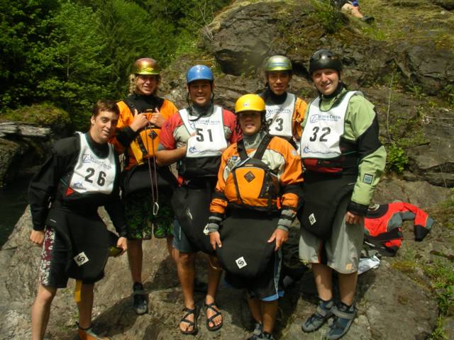
Hanging out with the World Class Academy kids before the start of the race. Posted by Hello

Canyon creek is a busy little creek that can be pretty friendly and fun to those less experienced with creeking. A couple of drops in the middle section pinch up and can be a bit technical, yet have fairly easy scouting. However once out of the tight walls of the upper section, you will soon find yourself at the brink of Big Kahuna, the first of 3 easy waterfalls (and also the starting line for the race). Basically the race begins as soon as your paddle hits the water in the eddy above 15' Big Kahuna. Upon landing cleanly you must then convert to flat-water sprinting through bony class II and III water for about 70% of the race section. As you near the finish, the final two drops known as the "Drop Zone" still must be ran cleanly before you hustle across the finish line that is located above the final drop of the creek. After the last drop, the creek becomes a lake that you must paddle across for 20 minutes to the bridge. If you are interested in challenging yourself against the clock and other fellow kayakers, the Canyon Creek Extreme Race offers a great introduction to downriver racing through drops. Congratulations to my sweet wife who won her class in the first extreme event she ever entered!


Michelle Basso launching the final waterfall before her finish in the 2004 Canyon Creek Extreme Race. Posted by Hello

2004 results and more information about the Oregon Cup can be found at: www.oregoncup.org

Thursday, April 29, 2004

Little White Salmon, WA - USA

If you ever are in the Portland Oregon area and the creek boat is on your roof, you mustn't pass a chance on the Little White Salmon River. Most certainly, the Little White ranks up there with the best creeks in overall class V creek quality, and season length. It along with the main White Salmon river, are located within an easy 25 min. drive across the Columbia River from Hood River Oregon, which is about an hour east of Portland.


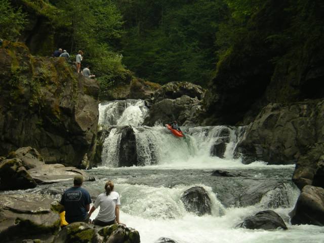
Spirit Falls awaits kayakers who want to huck near the end of the run. Posted by Hello

After pushing Mariann and Morten's out-of-gas van over the last remaining summit entering Oregon State from California, we cruised down into the night and arrived in Hood River the next morning. After some coffee, we took the toll bridge across the Columbia River and headed west down to the fish hatchery on Northwestern Lake which is the takeout. For the ultimate description of the Little White Salmon River, you can read in detail about this river and over 100 more located in the Pacific Northwest. Check out: Oregon Kayaking


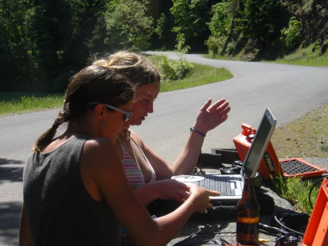
Girls playing with beers and laptops at the takeout after an epic on the Little White Salmon Posted by Hello

Thursday, April 15, 2004

South Fork Merced, CA - USA


Jayson, Scott and Mark at the takeout. Posted by Hello

The South Fork of the Merced is a tributary of the famous Merced River which steeply drains out of the heart of Yosemite National Park and rages along the main road. In April, the early California snowmelt makes the South Fork Merced come alive with the level around an ideal 1500cfs. What to expect if you are game for this intense overnighter is some very continuous pool drop class V, along with a couple of big California slides in the middle. Even after 2 weeks of ninja training on the Green River, I decided to portage more than once. Jayson and Scott on the other hand decided to fire it off.


A fluffy slide on the S. Fk. Merced...with a paddler at bottom! Posted by Hello

I joined up with Scott Feindel and Jayson Bowerman on the Kaweah River the previous day, and that evening we headed north from Fresno and entered the South Yosemite Park entrance late in the night. The South Merced put-in is in the national park village of Wawona, but within 20 minutes of class III paddling you exit the park boundaries and enter a magnificent wilderness canyon with all the class V whitewater goodies California typically has to offer.

If you knew this run well, you could probably push through the South Merced in one long day. However, you may end up paddling around 7 hours of continuous demanding whitewater. We followed the recommended option of camping overnight about 2/3rds into it. The camp comes after a hard section that ends with large distinct boulder that is in the middle of the rapid.....once in the calm water look for a level area on the left bank and watch out for the Poison Oak. The best part of breaking up this run into 2 days is that it enables you to get through most of the hard stuff on the first day and camp at an early time. Next day if you take-out early you can go hit the main Merced River playhole to cool off......yeah that's Cali....


Camp spot. Posted by Hello


Merced hole. Posted by Hello

Tuesday, April 13, 2004

Kaweah River, CA - USA

Scott Feindel back in Cali for 2004 - Kaweah River, CA. The Hospital Rock Section of the Kaweah River would serve as my introduction to creeking in California. Little did I know while winding up the steep road in Andrew Bell's old VW beetle that within the hour I would have already ran a 30 foot slide and then have my ass handed to me on a waterfall downstream. The Kaweah River flows down from an area in the Southern Sierras which is represented as Sequoia and Kings Canyon National Parks. Head East from the city of Visalia on route 198 and you will soon pass Lake Kaweah and enter Sequoia Nat'l Park. The takeout (which also includes "Brownstar Canyon" is only a mile up from the Park entrance and you can put in at Potwisha Campground. I met up with Scott, Jayson and Andrew B. in the town of Three Rivers just before the Park entrance. Andrew Bell close to home - C1 on the Kaweah.  There are numerous class V slides and drops on this section including the opening Hostpital Rock Slide and the rapid just below that constricts tighly as it drops into a boiling pool. As I came over the drop, I misjudged the line as my attention turned to Andrew who was still near the landing zone and immediatley after, "Welcome to California" would become my new name for that rapid. After this the river opens up and provides easy scouting so long as you watch out for the Poison Oak bushes and an exciting entry slide that ends with a fall facing towards the right wall. There is a higher takeout that we did not take which avoids the last canyon supposedly named "Brownstar Canyon" by one of Jayson's friends. What it really is are some more beauty drops before you reach a mini box canyon with some intimidating horizon lines. However a high climb up the right wall will put you on a ledge which reveals the goods. The Kaweah is a classic creek in California with dependble access and flows in the Spring. For flow information for the Kaweah and other Cali rivers check out: Dreamflows